Shocking images that show the impact of climate change in 2021
The climate crisis in pictures

In the year that the Intergovernmental Panel on Climate Change (IPCC) released its landmark report detailing the catastrophic consequences of global heating, there was a plethora of natural disasters. From lakes drying up to glaciers melting, biblical floods and apocalyptic sandstorms, these shocking images show that the impacts of the climate crisis are already being felt all over the world.
Snowstorm: Madrid, Spain
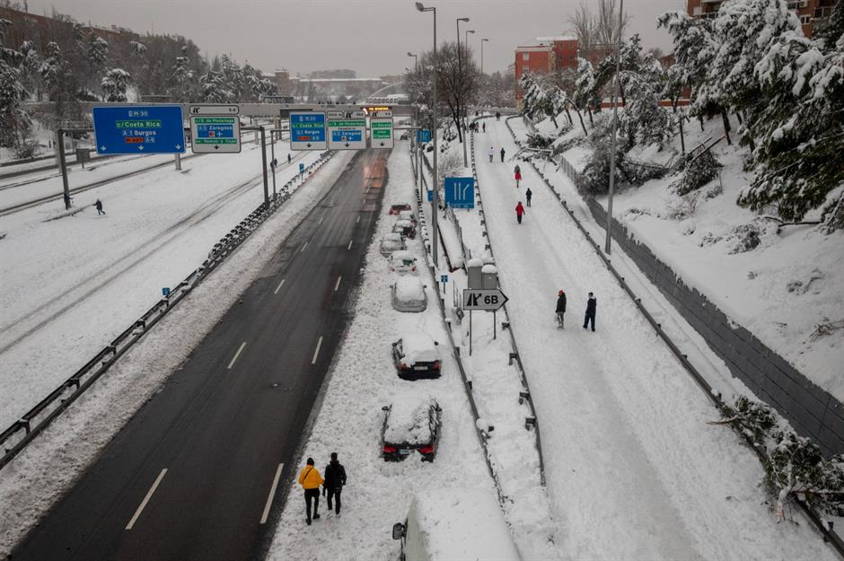
In the early weeks of 2021, Storm Filomena blanketed large parts of Spain with the heaviest snow in 50 years. The blizzard brought extreme transport disruptions: on this motorway near Madrid, captured on 9 January, cars were boxed in on all sides by heavy snow and roads were left empty. Damages from the storm cost an estimated 1.4 billion euros (£1.2bn/$1.6bn) according to The New York Times.
Coastal erosion: Happisburgh, Norfolk, England, UK
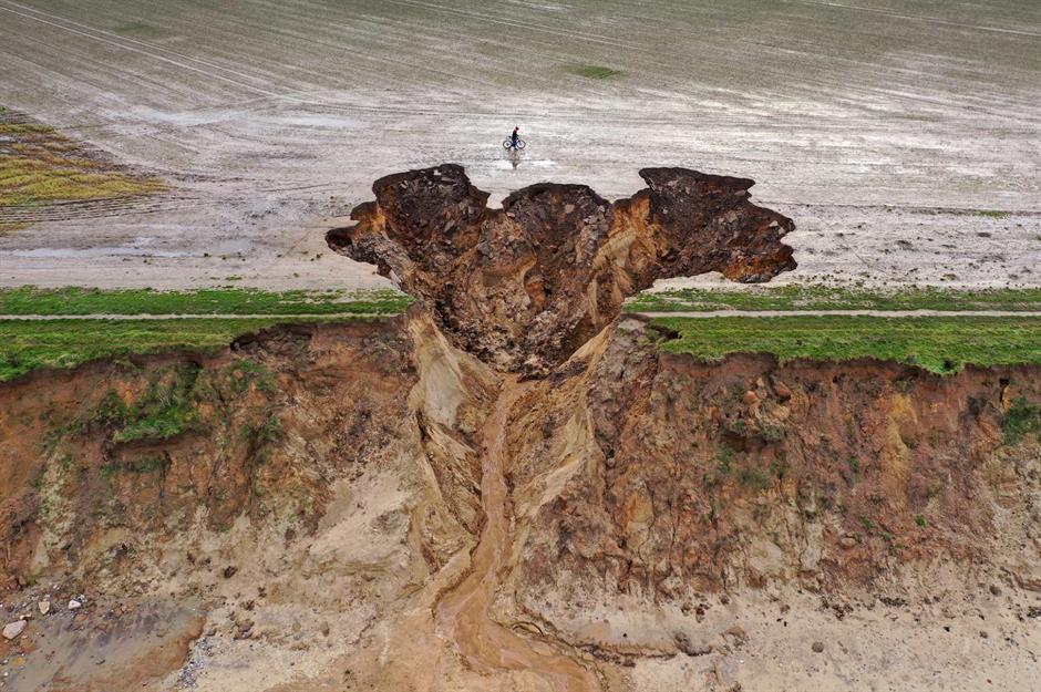
In January 2021, Storm Christoph brought extensive flooding across England and Wales. The extreme weather was particularly devastating for Happisburgh, a stretch of the north Norfolk coast, where the land became saturated with water causing large chunks of the cliff to collapse. The region faces a double threat of erosion from the sea, which will worsen as sea levels rise, and the land, which will deteriorate as climate change brings more flash flooding.
Follow us on Facebook for more climate change, weather and environment stories
Sandstorm: Oran, Algeria
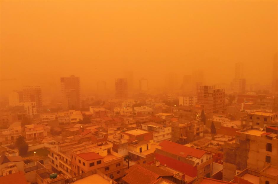
Turning the skies an alarming reddish-gold hue, the Algerian city of Oran was engulfed in a Saharan sandstorm in February. According to the World Meteorological Organization, the storm hit the north of the country on 5 February before making its way to southeast Spain, and then on through southern and central Europe. Although sandstorms are a natural occurrence, dry conditions caused by climate change are making them more frequent and intense.
Drought: Lake Suesca, Colombia
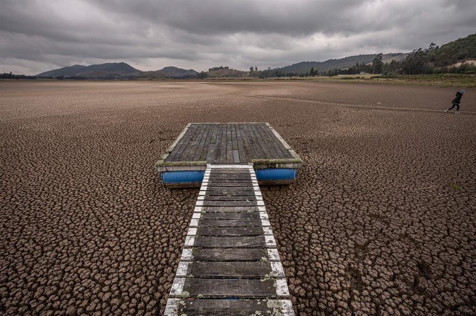
The water level at Lake Suesca, located in central Colombia, hit dangerously low levels in March. Northern Colombia has suffered from intense drought for years, with water scarcity at the heart of a humanitarian crisis for the Wayuu indigenous group in La Guajira.
Discover the world's landmarks under threat from climate change
Wildfires: Marsden Moor, Huddersfield, England, UK
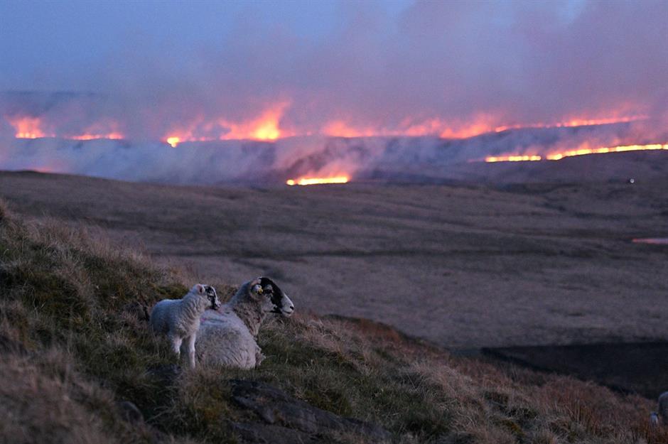
In April, a shocking fire broke out on Marsden Moor in west Yorkshire, destroying two square miles (5sq km) of moorland and lasting for 60 hours before it was extinguished. Although it’s thought that the fire was started due to irresponsible behaviour, dry conditions caused by climate change mean that such blazes can spread more easily.
Sandstorm: Beijing, China
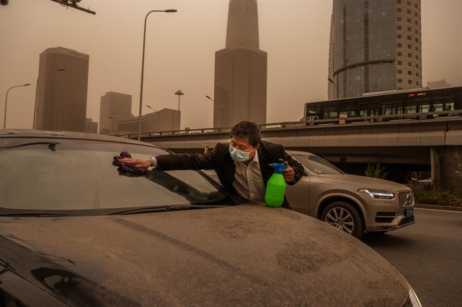
That’s not mud or dirt this man is cleaning off his car – it’s sand. On 15 April, Beijing was hit with its third sandstorm in five weeks, after strong winds whipped up sand from Mongolia and spread it through northern China. The scene was apocalyptic: skies turned an unnerving yellow-gold colour and the sun appeared eerily blue, while levels of the pollutant PM10 reached almost double the “hazardous” stage, according to Beijing’s Air Quality Index at the time. An earlier sandstorm in mid-March was called Beijing’s worst in a decade.
Cyclone: Shankarpur, Bay of Bengal, India
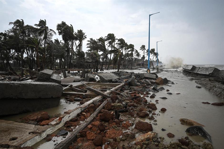
Hitting the states of West Bengal and Orissa on 26 May, just a week after Cyclone Tauktae devastated western India, Cyclone Yaas brought utter chaos to eastern India. With winds of up to 87 miles per hour (140km/h) and heavy rainfall, it ripped through tens of thousands of homes and forced 1.2 million people to evacuate. Cyclones in India are becoming more frequent and intense due to climate change, which could be catastrophic for the 14% of its 1.3 billion population that live on the coast.
Drought: Lake Mead, Nevada/Arizona, USA
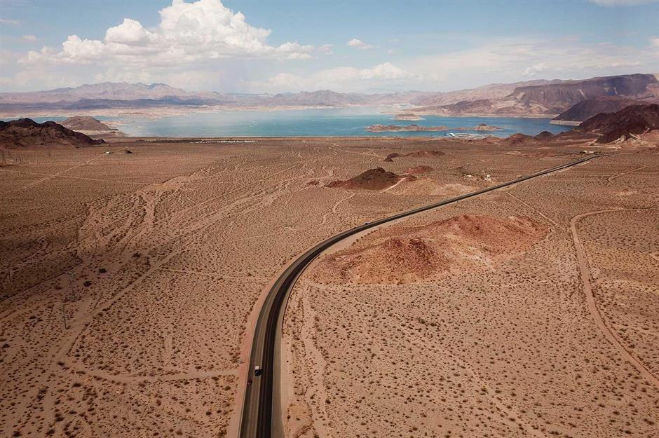
A man-made lake created by the Hoover Dam, Lake Mead is the largest reservoir in the US, straddling the states of Nevada and Arizona along the Colorado River. Yet its level is dropping scarily fast. As a consequence of years of epic drought, worsened by climate change, on 10 June the reservoir hit its lowest level on record. The accelerating drought led the federal government to issue its first-ever water shortage declaration, which will reduce the amount of water that can be taken from the river.
Wildfires: Oregon, USA
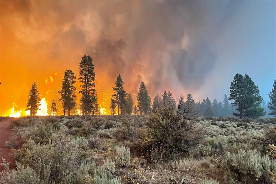
Few photos can quite do justice to the scale and ferocity of the Bootleg Fire, although this image is pretty terrifying. Tearing across 413,000 acres of land in Oregon for 39 days starting on 6 July, the blaze was the largest in the US in 2021 – until it was overtaken by California’s Dixie Fire in August. Shockingly, the Bootleg Fire was so large it generated its own weather, including “fire tornadoes”, some of which had wind speeds as high as 140 miles per hour (225km/h).
Click here to read about the world's most destructive forest fires
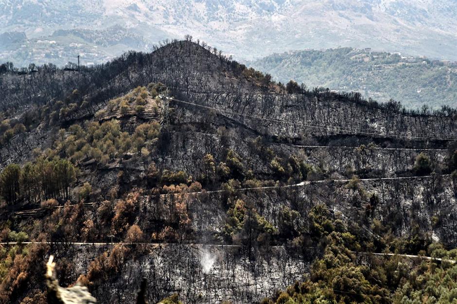
Wildfires: Ora, Troodos Mountains, Cyprus
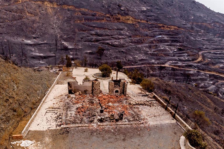
On 3 July, Cyprus was hit by its worst wildfire in history, which ravaged around 21 square miles (55sq km) of land in the southern foothills of the Troodos Mountains. Scenes such as this – a drone picture showing a burned-down house near the village of Ora – became all too common. The blaze is thought to have destroyed 50 homes, forced 10 villages to be evacuated and killed four people. At the time of the fire, temperatures in Cyprus were topping 40°C (104°F) and no rain had been recorded since April.
Flooding: Monreal, Eifel, Germany
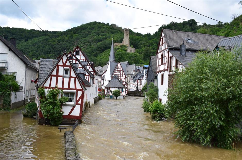
The climate emergency made this summer’s floods in western Europe “up to nine times more likely”, according to a recent study by the World Weather Attribution group. Pictured here, the village of Monreal’s historic half-timbered houses were partly submerged by the murky waters, after heavy rainfall caused villages and towns on the banks of the river Ahr to become flooded in mid-July. A total of almost 200 people were killed in the floods, which affected western Germany, parts of Belgium and the Netherlands.
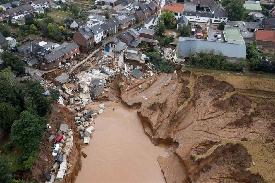
Flooding: Erftstadt, Germany
Flooding: Lahore, Pakistan
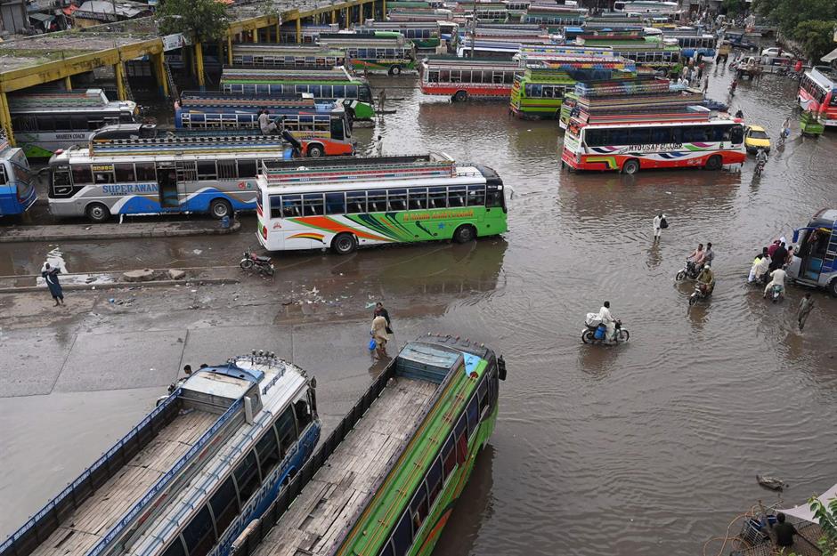
Pakistan has a monsoon season between mid-June and September. But the climate crisis is predicted to drive more intense rainfall within a shorter period, which, combined with longer dry periods for the rest of the year, will result in more extreme weather: flooding, drought and wildfires. Between 1 July and 9 September there were more than 160 fatalities linked to the 2021 monsoon season. The cities of Lahore (pictured), Islamabad and Karachi were all badly hit by heavy rain, flooding and landslides.
From 1900 to present-day, these are the world's worst floods
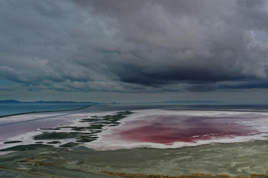
A lagoon turned pink: Patagonia, Argentina
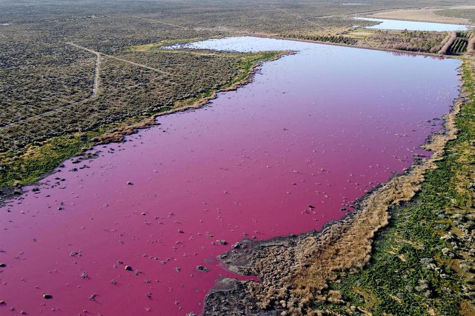
The neon-pink colour of this lake in southern Patagonia isn’t the result of natural phenomena – it’s caused by pollution. In July, Corfo Lagoon turned this shocking hue after fish factories dumped waste containing sodium sulphite, which is used in the treatment of prawns, into its waters. Residents have long complained about pollution and foul smells near the lagoon, as a result of the nearby fish processing plants.
Wildfires: Gorny Ulus, Sakha, Siberia, Russia
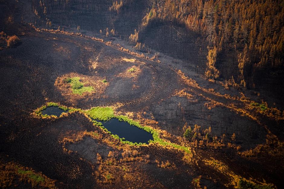
Following the driest summer in 150 years, Russia has endured the worst fire season in modern history. It began in late April and advanced rapidly in mid-June, with smoke from the fires even hitting the North Pole for the first time since records began. Forests turned from verdant green to charcoal black in Gorny Ulus, part of the republic of Sakha (also known as Yakutia), which was the hardest-hit region.
Wildfires: Yakutsk, Sakha, Siberia, Russia
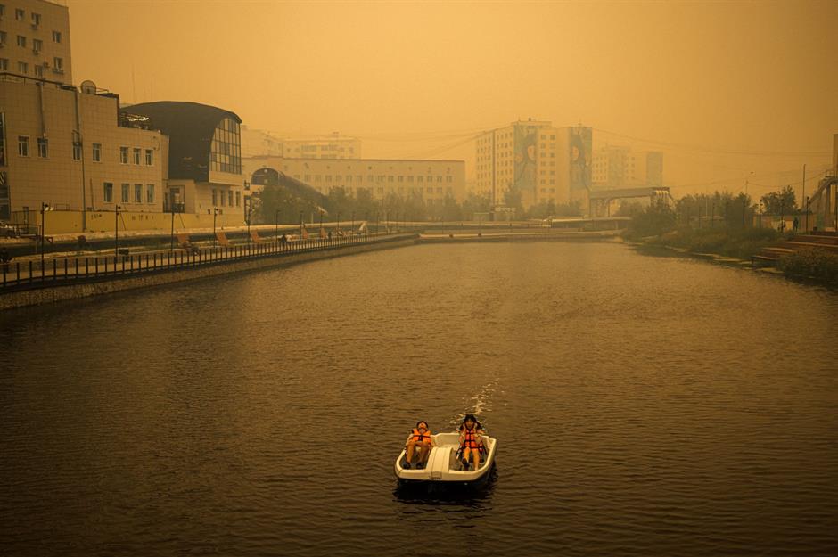
In mid-July, the city of Yakutsk was filled with toxic smoke from the nearby forest fires. Levels of the pollutant PM2.5 hit more than 40 times the level regarded as safe by the World Health Organization, with residents being ordered to stay indoors to avoid breathing in the deadly smog. The temperatures seen in Yakutsk were totally unprecedented: usually ranging between -42°C and 25°C (-44°F to 77°F) year-round, they reached a record-breaking 38.89°C (102°F) this summer. Local authorities have blamed climate change for the intense conditions which worsened the fires.
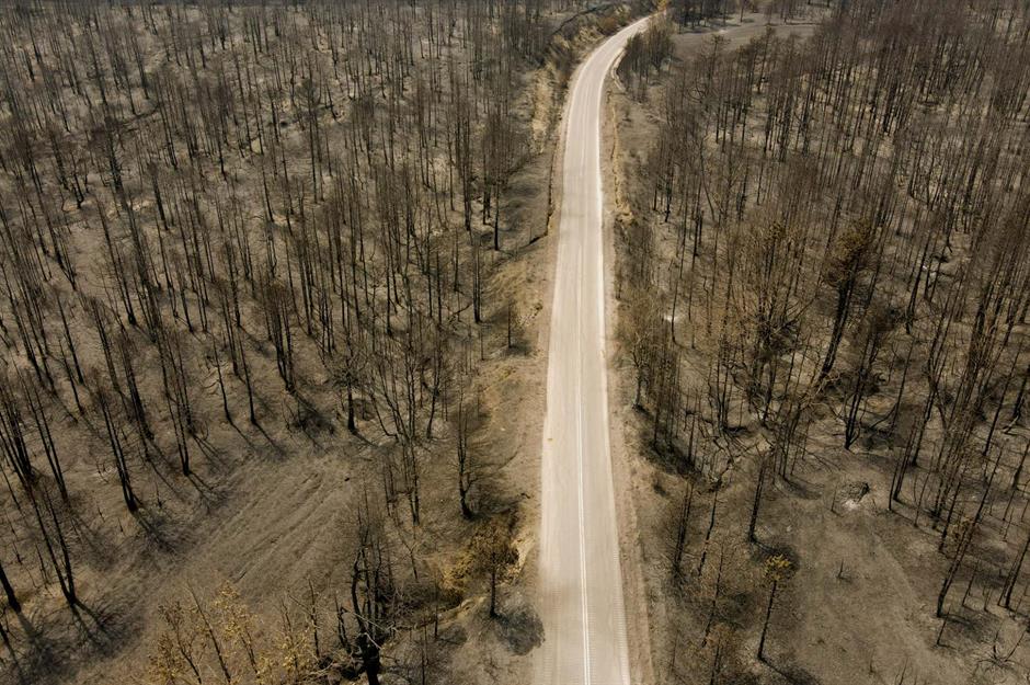
Wildfires: Lytton, British Columbia, Canada
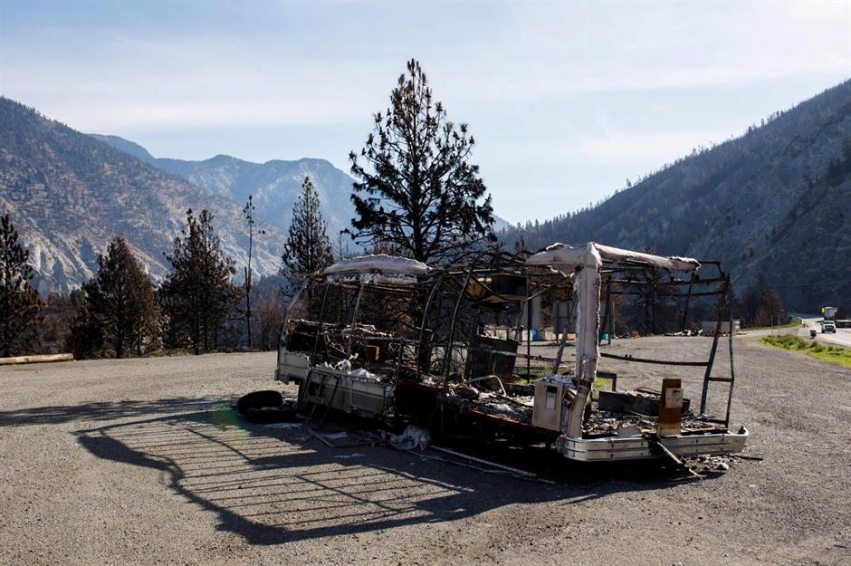
The western Canadian province of British Columbia is known for its epic mountains and verdant forests. Yet in summer 2021 it hit headlines for record-breaking high temperatures (which hit 49.6°C/121.3°F in Lytton on 29 June) and colossal wildfires, which devastated 3,354 square miles (8,686sq km) of land. Here, a burnt-out car near the village of Lytton, one of the worst-hit areas in the province, casts a skeletal silhouette across the razed valley.
Flooding: Henan Province, China
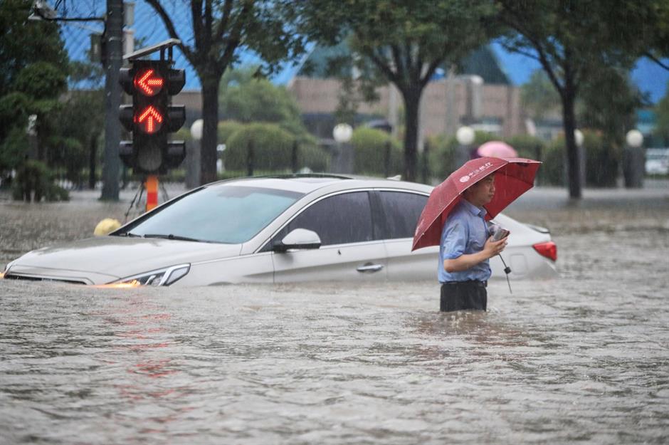
Central China’s Henan Province was decimated by record-breaking rainfall in mid-July, which brought deadly floods and landslides. In the province’s capital of Zhengzhou, where this image was captured, a year’s worth of rain fell in just three days. While flooding is routine in China during the summer, the events of July and August 2021 were undoubtedly intensified by climate change.
Flooding: Dhaka, Bangladesh
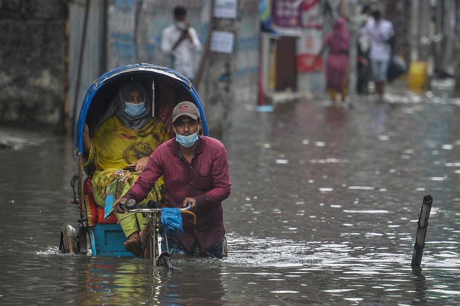
Bangladesh is a delta country, sliced apart by a labyrinthine network of 230 rivers. Following devastating floods in 2020, many parts of the nation once again became waterlogged in July and August 2021 – and the country’s monsoon season is only predicted to get worse due to global warming. Pictured here, a rickshaw driver in Dhaka struggles through the city’s flooded streets on 4 July.
Wildfires: Genesee Valley, California, USA
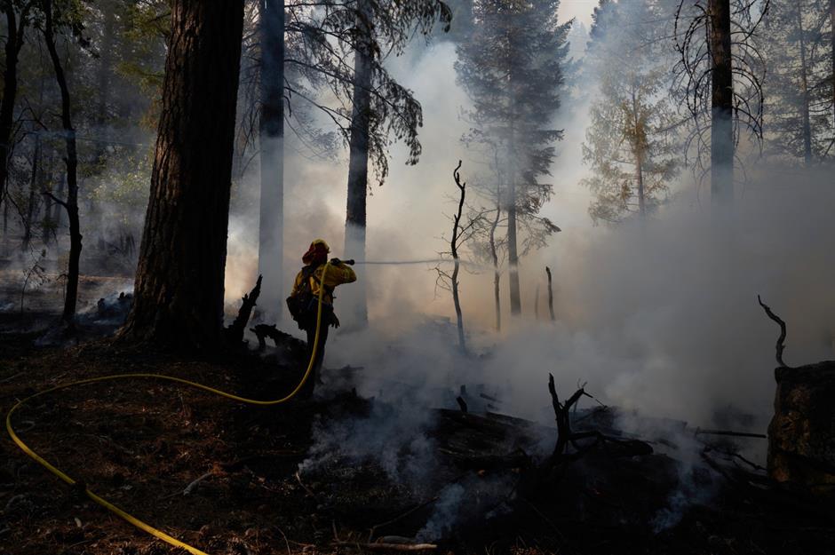
On 13 July, the Dixie Fire broke out near Feather River Canyon in Butte County. Two months later, the fire was finally contained, but the damage that’s been done is indescribable. Tearing across almost a million acres of northern California, it has destroyed more than 1,300 structures, wiped out entire towns and threatened ancient sequoia forests. Here, a firefighter extinguishes the flames in the Genesee Valley on 21 August.
Wildfires: Greenville, California, USA
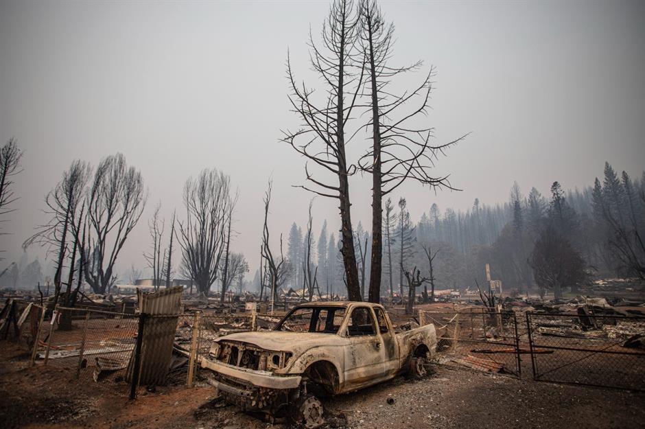
One of the biggest victims of the Dixie Fire was the Gold Rush town of Greenville in Plumas County. Fortunately, the town’s roughly 800 residents were evacuated safely, but around three-quarters of its buildings, some of which dated back to the mid-19th century, were engulfed by flames. Since then, it’s become an abandoned ghost town, as this haunting image of a burned-out car captures.
Now check out incredible abandoned places you can actually visit
Drought: Great Salt Lake, Utah, USA
After shrinking for years, Utah’s Great Salt Lake reached its lowest level on record on 24 July. Although the lake’s levels have historically fluctuated, high temperatures and low precipitation as a result of climate change have contributed to the extreme loss of water. But it’s not just the drought we should be concerned about. The lake’s salinity has increased dramatically, with the north arm now being eight times saltier than the ocean, which could soon be too salty for the region’s brine shrimp to survive.
Wildfires: Evia, Greece
Hot and dry summers mean that wildfires are common in Greece, but those which hit the country in August were the worst seen in decades. Scenes such as this – a charred pine forest on the nation’s second largest island, Evia – have become widespread after the fire claimed more than 100,000 hectares of land. The destruction of these forests doesn’t just mean a loss of natural beauty, but a loss of livelihoods: in Evia, tapping pine resin from trees represents a source of income for hundreds of families.
Drought: Lake Oroville, California, USA
Much of western America was gripped by catastrophic drought and extreme heat in summer 2021. Accelerated by these conditions, California’s second-largest reservoir, Lake Oroville, hit its lowest level since 1977 on 3 August. The waters dropped to just 643.5 feet (196m) above sea level – by contrast, they’re at 900 feet (274m) above sea level when the lake is full.
Wildfires: Kabylie, Algeria
The rolling peaks of Kabylie in northern Algeria are usually covered with olive groves and orchards. Yet the wildfires that hit the country in August have reduced many of its gorgeous landscapes to blackened wastelands. Beginning on 9 August, more than 100 fires were recorded across northern Algeria, killing at least 90 people and causing more damage to forests than the fires from 2008 to 2020 combined. Although the fires may have started by arson, climate change undoubtedly created the conditions to make them spread faster.
Wildfires: Navalmoral de la Sierra, Spain
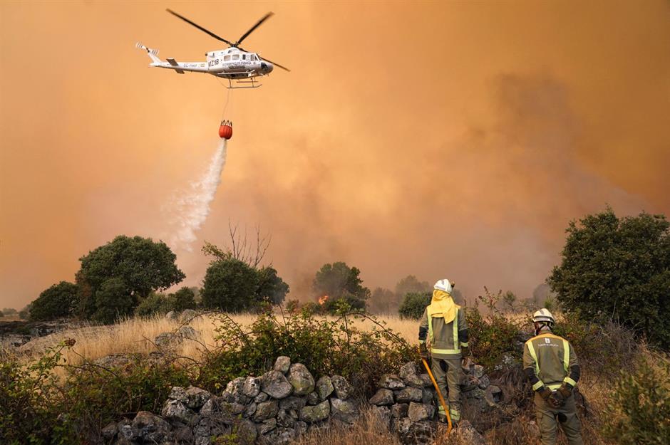
Against an apocalyptic yellow sky, an emergency helicopter drops water on fires at Navalmoral de la Sierra, in central Spain’s Ávila province. Scenes like this became common as the blazes began to spread in mid-August, destroying more than 20,000 hectares of land. According to Juan Carlos Suárez-Quiñones, head of the environment department in Castilla y León, record-high temperatures of close to 40°C (104°F) and low humidity created the “perfect storm” for the fires to spread. Less than a month later, wildfires devastated southern Spain’s Andalucía region.
Hurricane: Grand Isle, Louisiana, USA
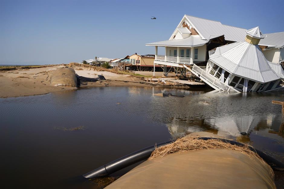
Torn down after a levy busted in Grand Isle, Louisiana, this beach house was badly affected by Hurricane Ida. But damage to buildings was just the tip of the iceberg. The storm hit the state on 29 August, tearing across 1,500 miles (2,400km) of land, leaving one million Louisianians without power (some for weeks afterwards) and costing a predicted $95 billion (£69.5bn) in damages. According to the IPCC report, the climate crisis is set to make hurricanes rainier and more intense in future.
Rainfall: Greenland ice sheet
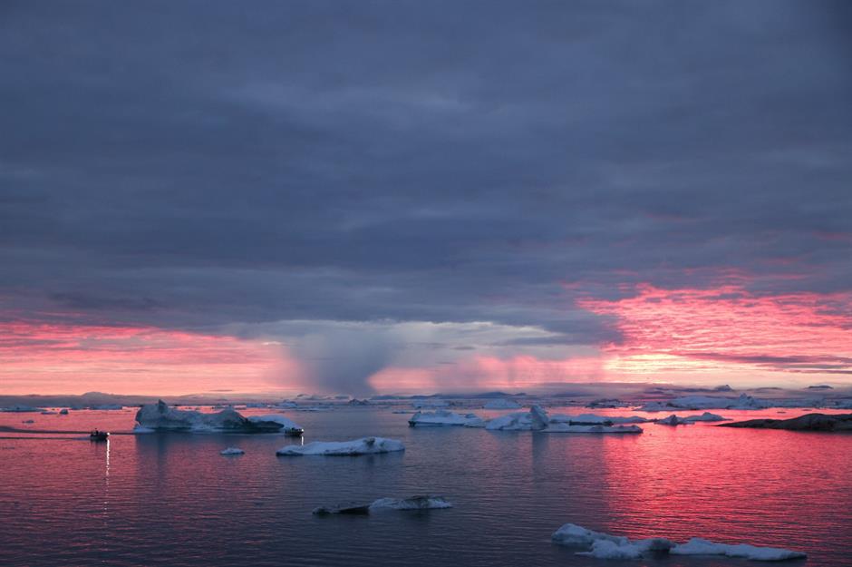
Lit up by an alarming red sunset, distant rain was captured falling on icebergs at Disko Bay, Greenland on 4 September. Less than a month earlier, scientists had raised the alarm after rain fell on the highest peak of the ice sheet for the first time ever, during an unexpectedly hot three-day period when temperatures were 18°C (32.4°F) higher than average in places. This comes just a few months after a report predicted parts of the Greenland ice sheet were nearing a climate tipping point, after which ice melt would become inevitable.
Tropical storm: Galveston, Texas, USA
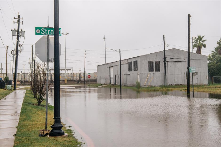
Streets like this one in Galveston, Texas, filled with water following Tropical Storm Nicholas in mid-September. America’s 14th named storm during 2021's Atlantic hurricane season, the event was downgraded to a tropical depression on 14 September after its wind speeds slowed down, although it still drenched southeastern Texas and brought heavy rainfall and flooding in Louisiana.
Wildfires: Long Meadow Grove, California, USA
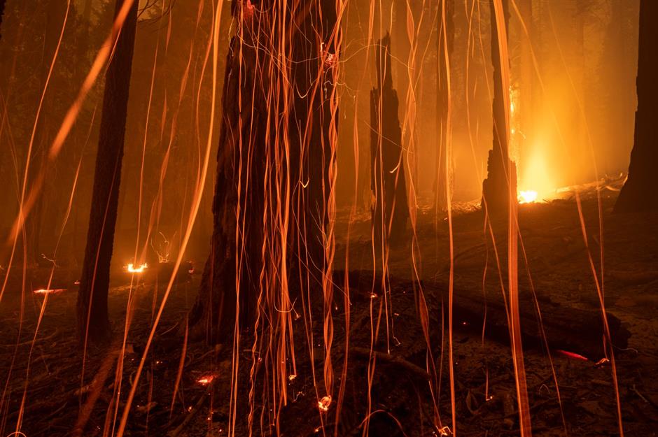
The Windy Fire burned across California’s Tule River Indian Reservation for more than two months. It has razed more than 97,000 acres but is now 100% contained. Intense drought, heat and low humidity at the time made it harder to contain the flames. Captured here on 21 September, the flames engulfed Long Meadow Grove, near the historic Trail of 100 Giants. Despite attempts to protect these iconic trees, some of which are 2,000-plus years-old, the Bench Tree was said to be badly burned.
Toxic foam: Delhi, India
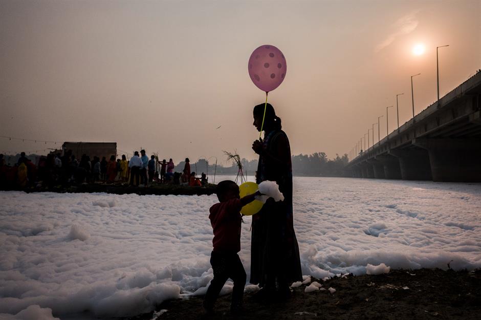
During the Hindu festival of Chhath Puja, which took place between 8 and 12 November 2021, believers flocked to bathe in the sacred Yamuna river, a tributary of the Ganges. But their rituals were hindered by pollution, after the waterway became clogged with toxic foam linked to industrial waste upstream. According to scientists, the substance had high levels of ammonia and phosphates, which can lead to breathing problems and skin conditions.
Air pollution: Delhi, India
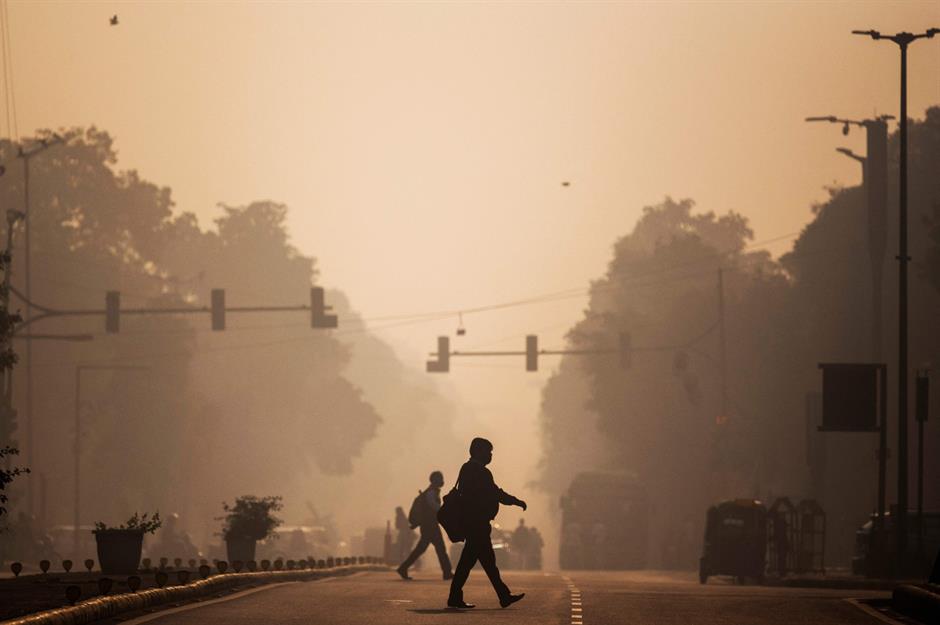
In November 2021, air pollution in the Indian capital got so bad that schools, colleges and offices had to close. The city reached a terrifying 451 out of 500 on the Air Quality Index (AQI) during the first week of Diwali in early November – for context, any number above 100 is considered unhealthy. As well as motor vehicles, the city’s toxic smog is caused by burning of rubbish, coal-fired power plants and agricultural fires, although India has invested heavily in reducing these recently.
Comments
Be the first to comment
Do you want to comment on this article? You need to be signed in for this feature