The US Interstate's fascinating secrets revealed
Life is a highway

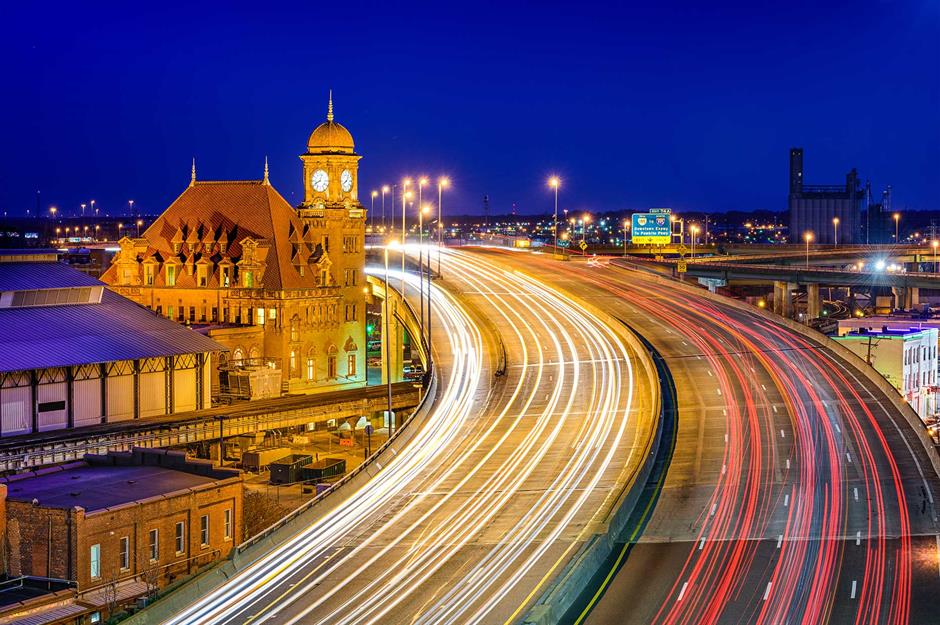
Spanning approximately 46,876 miles (75,440km), the US Interstate Highway System is one of America's most significant achievements. Connecting rural areas with bustling cities, it has become the backbone of America's celebrated road trip culture.
Click through the gallery to discover quirky facts, debunked myths and the fascinating origins of this iconic network of roads, including its surprising German connection...
The Interstate system was constructed after the Second World War
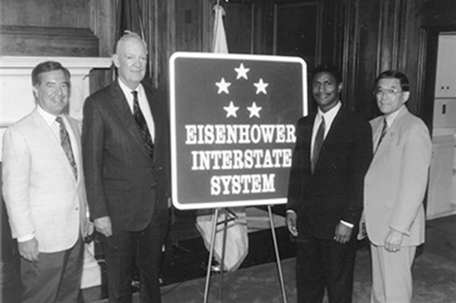
The system's official name is the Dwight D. Eisenhower System of Interstate and Defense Highways. On 29 June 1956, President Eisenhower signed the Federal-Aid Highway Act, giving the green light to a 41,000-mile (66,000km) road network intended to boost economic development and improve highway safety. There had been talk of expanding America’s roads for years but Eisenhower finally got the ball rolling (or wheels turning), partly, and ominously, to provide quicker evacuation routes in case of an atomic attack.
The system was part-inspired by Germany
During the Second World War Eisenhower took supreme command of the allied forces pushing into Germany, and marvelled at the efficiency of the country's vast autobahn (highway) system. He later said: “After seeing the autobahns of modern Germany and knowing the asset those highways were to the Germans, I decided, as President, to put an emphasis on this kind of road building... Germany made me see the wisdom of broader ribbons across the land."
There’s an order to the numbering
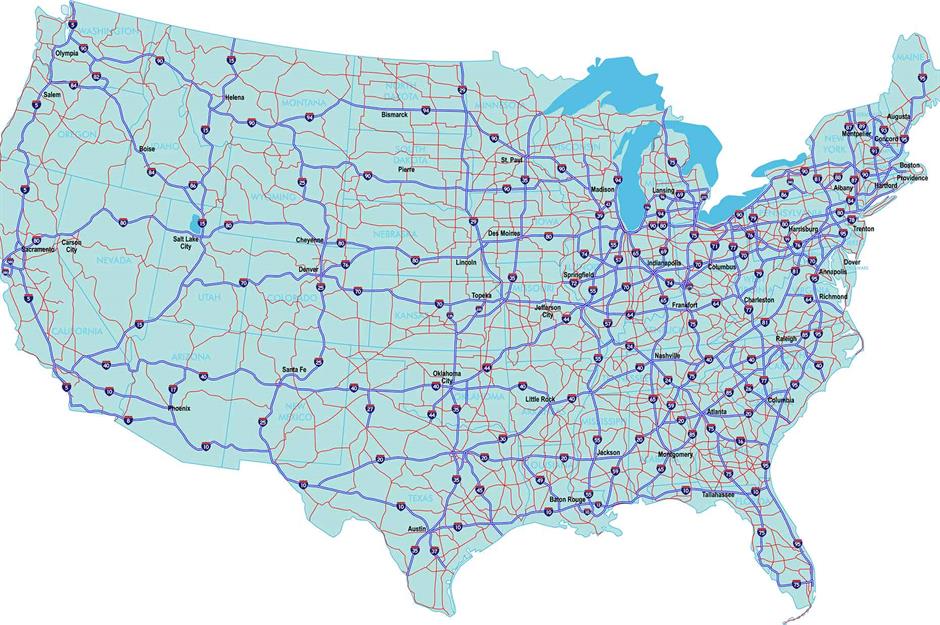
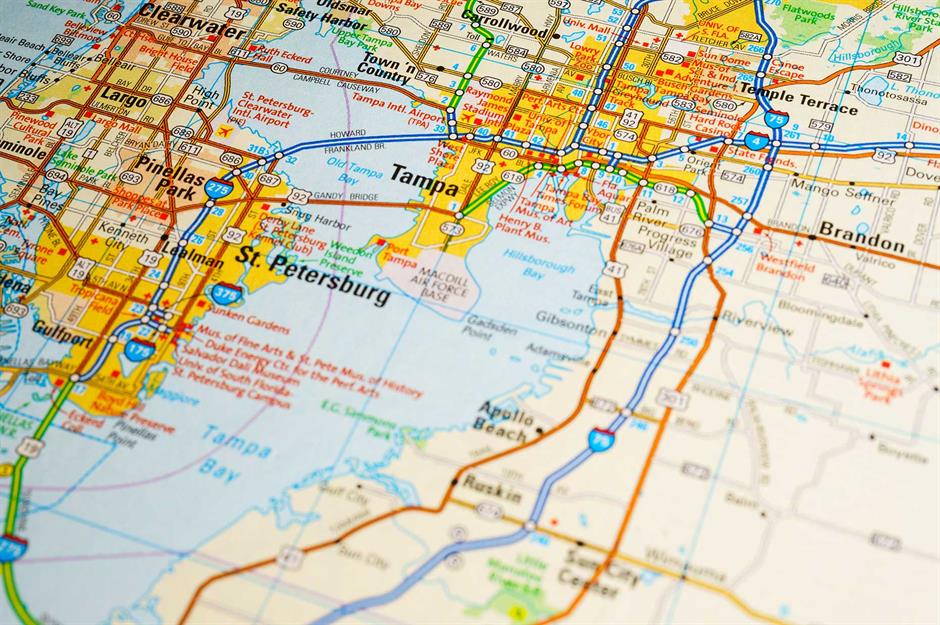
If you look at a grid map of the US Interstate system, you’ll see that two-digit routes running north to south are marked with odd numbers, and routes running east to west are marked with even ones. Three-digit freeways are smaller roads and bypasses that branch off larger highways, and the second and third digits show which major highway they branch off from.
Love this? Follow our Facebook page for more travel inspiration
The roads have served as emergency airstrips
There's a widely circulated myth that for every five miles (8km) of Interstate road, there must be a straight one mile (1.6km) stretch that can accommodate emergency plane landings. It's not an official law, but the US Department of Transportation Federal Highway Administration (FHWA) does state that airplanes have periodically landed successfully on Interstates when there’s been no alternative.
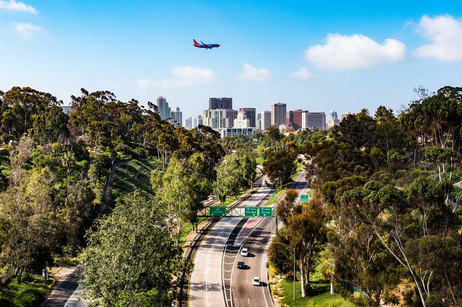
The I-8 runs well below sea level

The I-8 spans around 350 miles (564km) between San Diego in California and Casa Grande in Arizona and has the lowest elevation in the entire Interstate system, dipping to 52 feet (15m) below sea level in Imperial Valley near El Centro, California. And here’s another unusual fact: nearly half America's avocado crop is grown near this highway. Anyone for brunch?
Travelling across the country used to take well over a month
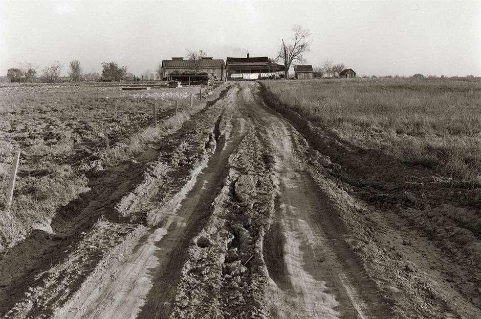
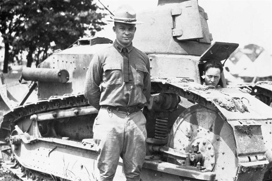
Before the Interstate system, it could take the US Army up to 92 days to travel from one side of the US to the other. Eisenhower himself was part of an 81-vehicle convoy that spent 62 days trundling from Washington DC to California in 1919, averaging 58 miles (93km) a day. Reasons for delays included mud ditches, few paved roads and even quicksand. This arduous trek significantly influenced Eisenhower's vision for a new era of road building, ultimately leading to the creation of the Interstate Highway System.
Interstates ending in 0 and 5 are the most important
The Interstate system is nothing if not logical, and two-digit numbers ending in 0 and 5 are reserved for the most important cross-country routes. The I-10, for example, hugs America's southern shores and border, tracing all the way from Los Angeles to Jacksonville; the I-95 follows the east coast from Florida all the way up to Houlton, Maine; and the I-40 bisects the country east-west starting in Barstow, California and ending in Wilmington, North Carolina.
The oldest Interstate is a hot topic
Exactly which is the oldest Interstate is a little controversial. According to the Federal Highway Administration (FHWA), Missouri's US 40 (later part of the I-70 Mark Twain Expressway) was the first project to start construction with Interstate funds in August 1956. Meanwhile, in Kansas, a road-building project was already in progress and received its final paving contract under the new Interstate legislation. Thus, Missouri's project was the first to begin construction, while Kansas' project was the first to be completed. Both states erected signs at the time claiming the title of the 'first' Interstate, reflecting the ongoing debate over this distinction.
New Interstates are in the works
The I-27 in Texas currently connects the cities of Lubbock and Amarillo, but in March 2022 it was announced that the route would be extended north to Raton, New Mexico and south to the Texan border city of Laredo. The extension is in the advanced planning stages following its official designation as part of the Interstate Highway System, and once completed will provide a continuous route from the Texas-Mexico border nearly to Colorado.
Some regions have their own systems
Hawaii, Alaska and Puerto Rico are also part of the Interstate system, just not in the same way. They don't connect to any other states, obviously, but they do get access to federal funding. Hawaii’s four Interstate highways serve both civilians and military personnel, and all end at military facilities like Marine Corps Base Hawaii. Alaska’s four designated Interstates weren’t constructed to official Interstate standards, and so are signed as Alaska state routes instead. It's the same in Puerto Rico, and its three highways are coded PR-1, PR-2 and PR-3.
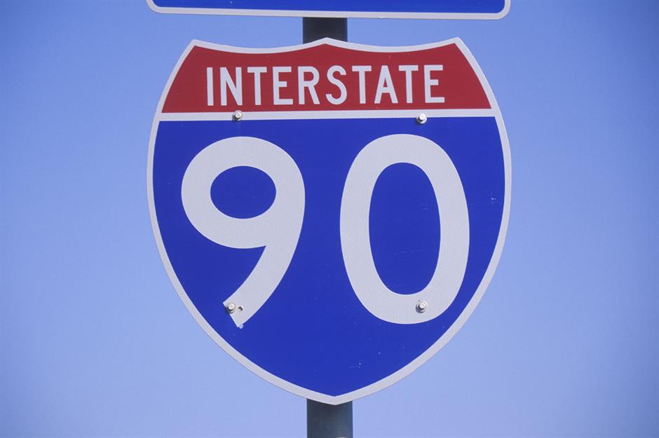
The longest highway is over 3,000 miles (4,800km)
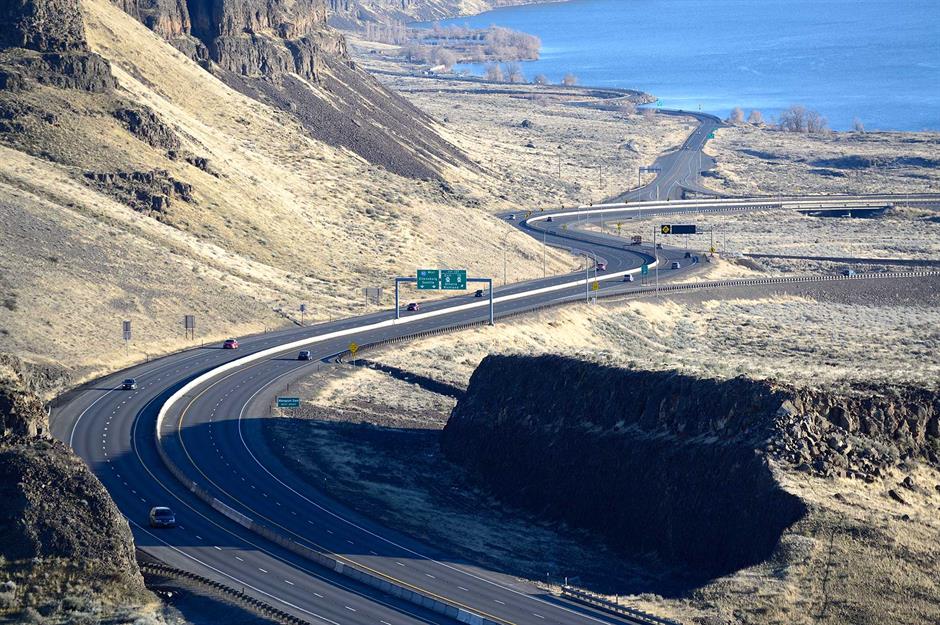
The mighty I-90 is the longest Interstate highway, spanning the 3,020 miles (4,860km) between Seattle in America's northwestern corner and the city of Boston, Massachusetts. This coast-to-coast highway crosses 13 states, touching major cities like Buffalo, Cleveland, Chicago and Albany. Pictured here is a stretch of the I-90 skirting the Columbia River in Washington.
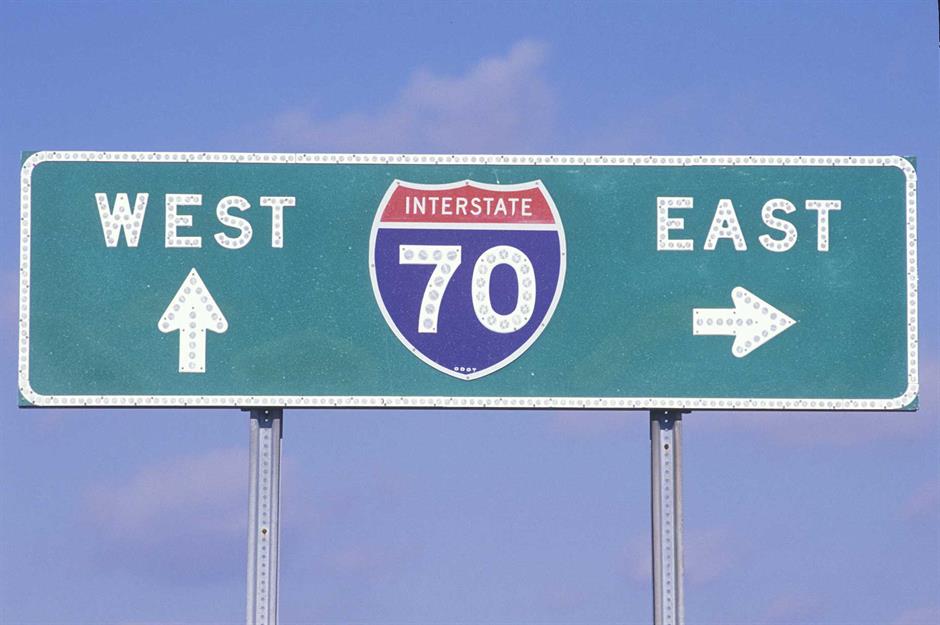
The I-70 is probably the most scenic Interstate
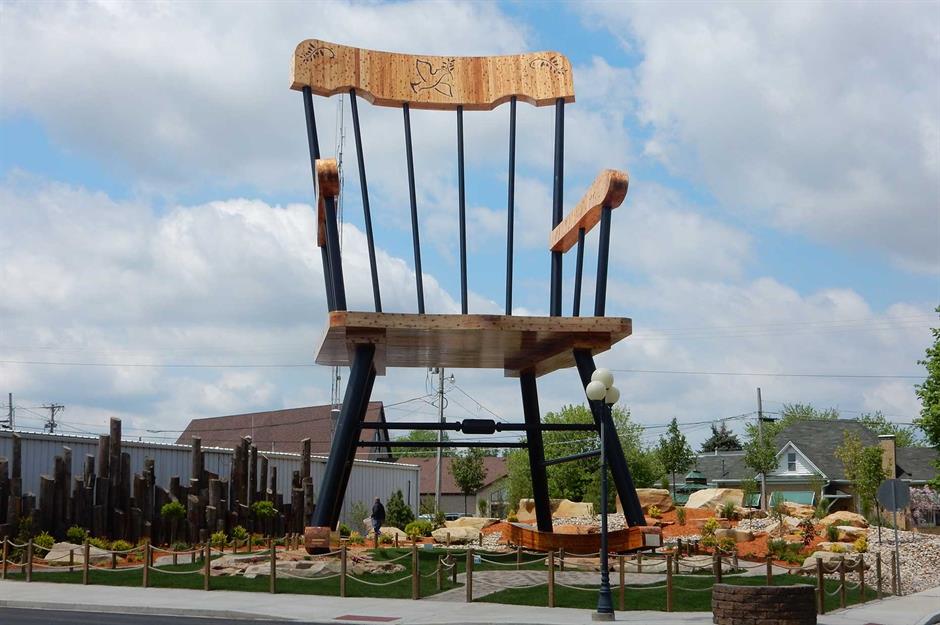
Route 66 may be the most famous of the Interstate's many highways, but the I-70 will see you breeze through remote wilderness, sweep through lively cities and make multiple stop-offs at giant roadside attractions. The 2,151-mile (3,462km) route incorporates the Eisenhower Tunnel, once the highest vehicular tunnel in the world, and the world's largest rocking chair in Casey, Illinois. Make sure you stock up on snacks – the road includes a 110-mile (177km) stretch in Utah without any service stations.
Hawaii has the shortest major Interstate
Across the entire Interstate system Hawaii’s H-2 is the shortest major highway at just 8.3 miles (13km), running between Pearl City and Wahiawa on the island of Oahu. On the US mainland the shortest is the I-87 between Raleigh and Wendell in North Carolina, at just 13 miles (20km). Once you get into smaller three-digit highways the distances get a lot shorter, and the I-878 in New York City is just seven tenths of a mile (1.1km) long.
Odds and evens all add up

Generally speaking, three-digit routes that start with even numbers make loops around cities, whereas those that start with odd numbers lead directly into cities from their respective highways. Take Boston, Massachusetts as an example: there's the I-495, which acts as a 121-mile (195km) ring road around the city, and the I-190 which splits off from the I-90 outside Boston to directly link the cities of Worcester and Leominster.
Interstate numbers repeat themselves
Smaller highways often reuse route numbers as long as the relevant routes are a long way apart. You’ll find separate I-76s in Pennsylvania and Colorado and I-87s in New York and North Carolina. Major two-digit routes – like those ending 0 or 5 – must be unique.
Interstate highways have specific regulations

To be an official Interstate highway a road must meet certain design standards. Among other things, highways must have a minimum of two 12-foot-wide (3.6m) travel lanes in each direction, a 10-foot-wide (3m) right-hand paved shoulder, full control of access and speed limits between 50 and 70 miles per hour (80km/h and 113km/h). The roads must also show they can handle expected traffic volumes for at least 20 years.
Some Interstates are unsigned
Did you know that some Interstate routes are unsigned? They’re still part of the Interstate system, but so as not to confuse drivers with additional numbers on already-signed roads, they’re only official on paper. The I-595 in Maryland is a good example: it shares a portion of the same stretch of road (from New Carrollton to Annapolis) as the more-popular I-50, so only the I-50 is marked.
You can (sort of) see the Interstate system from space

It's mostly a myth that the Interstate system can be seen from space, but the Federal Highway Administration admits that there's at least a grain of truth to the claim. From an altitude of 155 miles (250km) and under good conditions, astronauts using binoculars can see sections of the Interstate system like particularly large roads and dams. Tenuous, we know.
Hawaii's H-3 highway was outrageously expensive

On a cost-per-mile basis, Hawaii's H-3 is almost certainly the most expensive Interstate highway in the entire network. With a price tag of more than £1.1 billion ($1.3bn), which works out to £71 ($80m) per mile, the controversial project was completed in 1997 after 37 years of development hell and widespread objections from Indigenous peoples. The ultra-scenic 15-mile (25km) road connects state capital Honolulu with Marine Corps Base Hawaii.
We have Texas to thank for the Interstate shield
An American icon, the shield-shaped design of Interstate signage was put forward in 1957 by Richard Oliver, an employee of the Texas Highway Department, though it has been slightly revised three times since then. The sign has been a registered trademark since 1967 to prevent Interstate-like advertising signs from confusing motorists.
There were protests against the Interstate system's construction
In the 1960s highway planners were surprised when the Interstate system wasn’t universally welcomed – after all, it promised improved accessibility and reduced commuting costs. But in many areas locals were worried that their communities could be destroyed, and over time those living near freeways found that their land depreciated in value. Between 1967 and 1968 alone there were some 123 highway revolts and road-related protests across the United States.
Four state capitals are Interstate-free
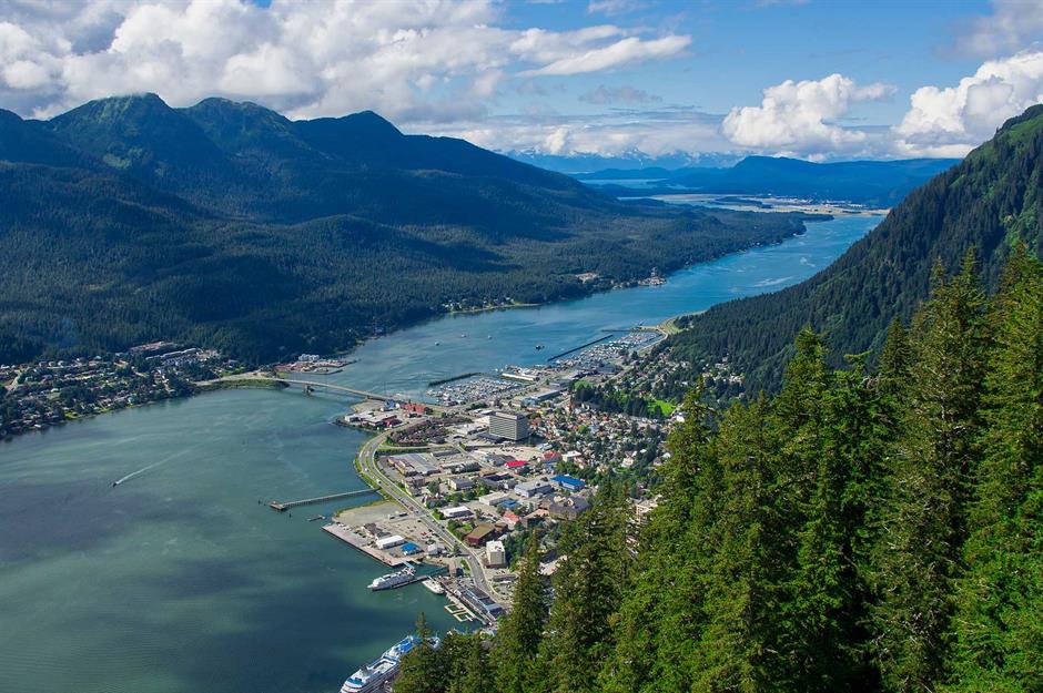
There are four state capitals that aren't directly served by the Interstate system: Juneau in Alaska, Dover in Delaware, Jefferson City in Missouri and Pierre in South Dakota. Juneau can only be reached by air or sea – there are no roads to the city at all – while Jefferson City's proposals for an Interstate link to I-70 fell on deaf ears. Still, they're charming towns worth seeking out.
The I-75 includes a mega-long bridge
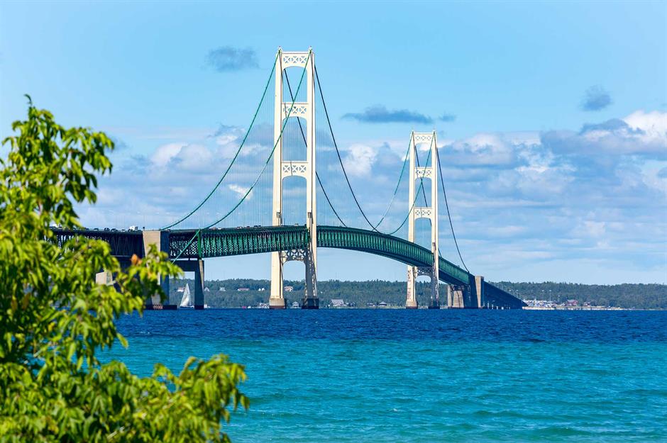
At 1,786 miles (2,875km) long, the I-75 runs from Miami to Michigan, stretching all the way through Georgia, Tennessee, Kentucky and Ohio. But the real route highlight is the Mackinac Bridge, spanning 26,372 feet (8,038m) over the Straits of Mackinac between the Great Lakes Michigan and Huron, making it the third-longest suspension bridge in North America and the 24th longest in the world.
Route 66 was built for farmers

These days, Route 66 is perhaps the ultimate US road trip, but it started life as the first all-weather highway in 1926. Connecting Chicago to Los Angeles, it initially served as a commercial route for farmers to transport their crops, then became a crucial pathway for moving military supplies and personnel to bases in the west during the Second World War. Today, Route 66 remains an iconic symbol of American travel and adventure.
Comments
Be the first to comment
Do you want to comment on this article? You need to be signed in for this feature