Vintage photos from 19th-century Latin America
Back in time

The 19th century was a time of great change in Latin America. Increased contact with Europe brought growth and innovation to its cities as well as increased competition for its resources, which often culminated in skirmishes and wars. At the same time, fabulous Inca and Maya ruins were being excavated for the first time after lying hidden for centuries.
Click through this gallery to see evocative images that capture the wonder and awe of this era in Latin American history…
1849: An Inca ruin, Bolivia or Peru
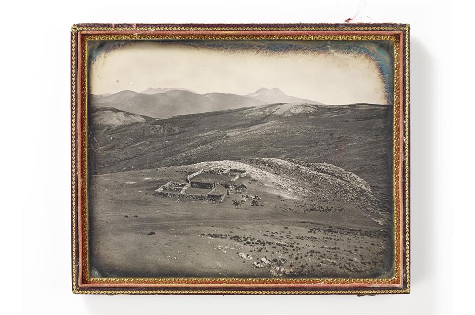
This photo captures the remains of an ancient Inca tambo, or inn, and is believed to be one of the earliest photos ever taken in Latin America. It is attributed to American photographer Robert H Vance, who went on to achieve fame with his images of the California gold rush. Capturing the image would have been a Herculean task. The equipment needed to take these early photographs was bulky and heavy, and this particular tambo sat at a height of 16,000 feet (4,877m) in the Andes Mountains, somewhere in Peru or Bolivia.
1860: A lady and her litter bearers, Brazil
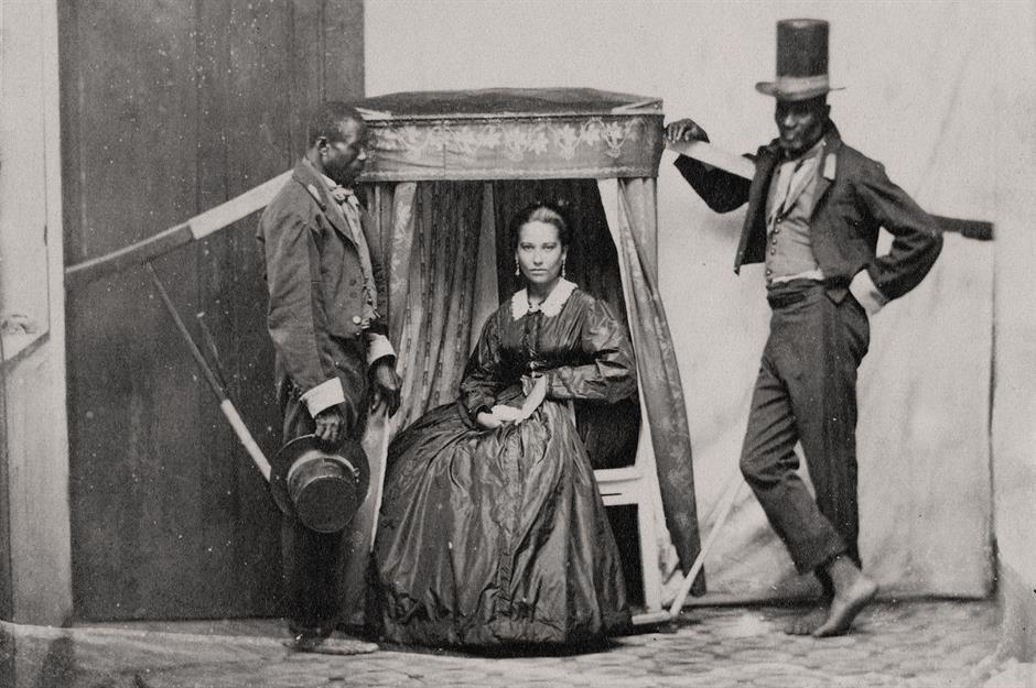
Slavery lasted for 300 years in Brazil, with over four million Africans imported into the country during that time. It was also the last place in the Americas to abolish slavery in 1888, so the final years of the practice were captured on film. This photo of a Brazilian lady and her litter bearers was taken in Bahia in 1860. The fancy clothes suggest that the two gentlemen may be men of means, but they were only worn for the photo. Their real status is denoted by their bare feet, as in Brazil enslaved people were not allowed to wear shoes.
c.1860: View of Rio de Janeiro, Brazil
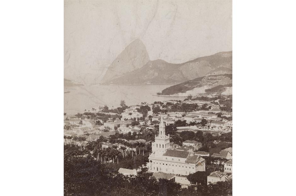
Surrounded by otherworldly granite monoliths and sparkling under the Brazilian sun, Rio de Janeiro’s stunning harbour is rightly regarded as one of the Seven Wonders of the Natural World. Its beauty is apparent in this photo, taken around 1860, looking out across Flamengo towards Sugarloaf Mountain. The area takes its name from the beach, Praia do Flamengo, which means 'Beach of the Flemish'. Some sources claim that Dutch sailor Olivier van Noort tried to invade Rio here back in the 1500s, and at that time the Portuguese referred to the Dutch as 'Flemish'.
1865: Crushing mill at El Nopal silver mine, Mexico
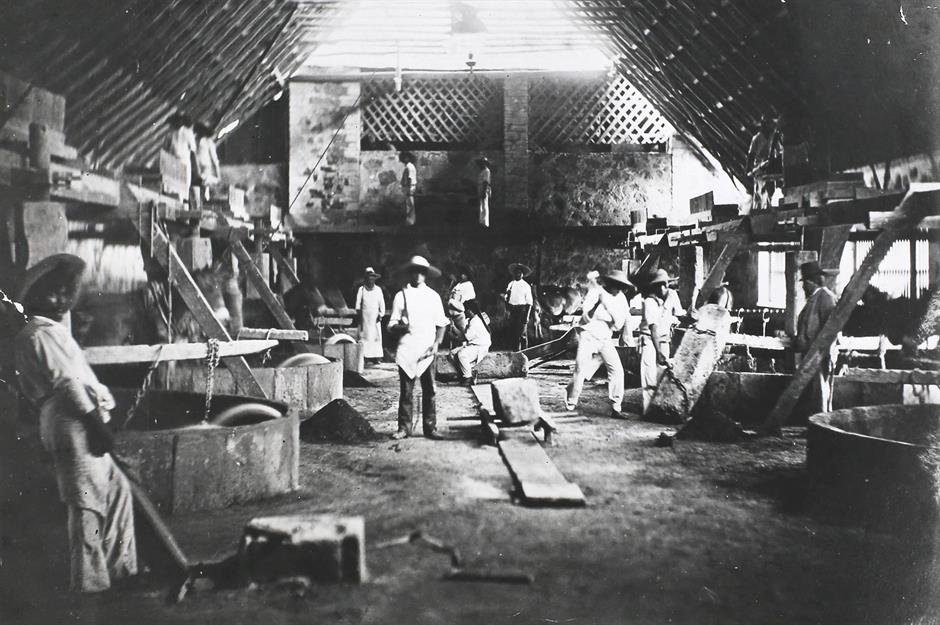
The so-called New World was a treasure trove for the European nations that colonised it, not just thanks to the ancient artefacts they plundered but also to the rich resources they could extract too. Here we see workers in the crushing mill at the El Nopal silver mine in Guanajuato, Mexico. The Spanish began mining silver here in 1548 and some of the mines in this UNESCO-listed town are still operational today. Visitors can arrive in the town via an old mining tunnel and can then tour 'Boca del Infierno', a mineshaft that plunges a breathtaking 1,969 feet (600m).
1868: The romance of the gauchos, Argentina
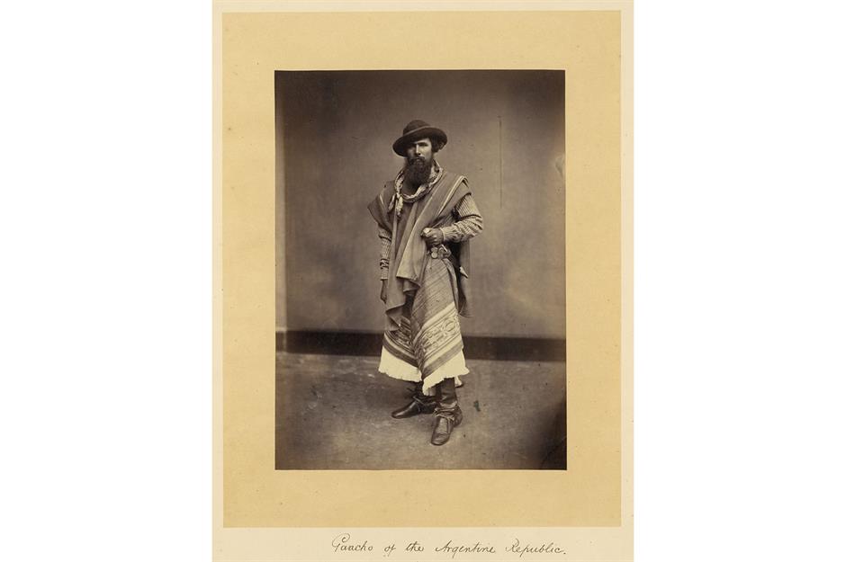
Cutting stylish figures in their heavy woollen ponchos, high leather boots and long pleated trousers (called bombachas), gauchos roamed the vast pampas (grasslands) of Argentina, rounding up escaped cattle and living lives as romantic and exciting as their cowboy cousins to the north. This studio shot was taken by Eugenio Courret, a French-born photographer based in Chile, who was most famous for photographing several major events across the region, including the War of the Pacific between Chile and the united forces of Bolivia and Peru.
Love this? Follow us on Facebook for more travel and history features
1868: A tsunami wipes out Arica in modern-day Chile...
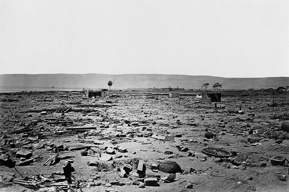
On 13 August 1868, the flourishing town of Arica (then in Peru but now in Chile) was hit by one of the most powerful earthquakes in history. Some modern estimates suggest that the megaquake measured 9.0 on the Richter scale, but it was the approximately 50-foot-high (15m) waves of the subsequent tsunami that wiped Arica off the map. As seen here in this photo taken in the aftermath of the disaster, houses, bridges and railway lines were all washed away, with the ships in the port either crushed on rocks or flung inland. Part of the rusty wreck of the American schooner, the Wateree, can still be seen on the north shore of Arica today.
1868: ...and devastates Arequipa in Peru too
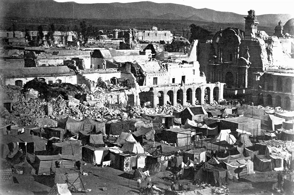
The Arica earthquake was so powerful that most of the towns in southern Peru were almost completely destroyed. Here we see a tent city set up among the devastated buildings around the main square of Arequipa, a mountain town some 164 miles (264km) north of Arica that's now Peru's second-largest city. All told, close to 25,000 people died across the region, with towns like Arica and Arequipa, as well as Tacna, Moquegua, Mollendo, Ilo, Iquique and Torata, taking decades to recover.
c.1870: Climbing Popocatepetl volcano, Mexico
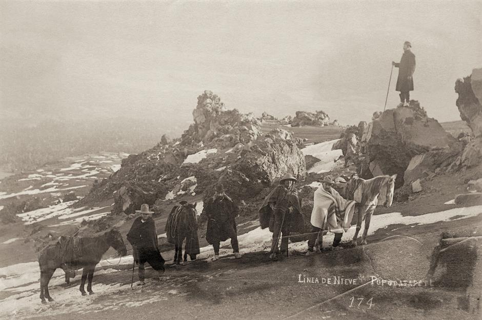
Popocatepetl means 'smoking mountain' in the Aztec language, and at 17,930 feet (5,465m) is the second highest mountain in Mexico and the fifth highest in North America. Seismic rumbles saw the mountain closed to climbers in 1994, a decision vindicated by a spectacular eruption in 2000, the biggest in more than a thousand years. Here we see a horse-back expedition reaching the snowline sometime around 1870. One story holds that Aztec emperor Montezuma sent 10 warriors to climb Popocatepetl in the early 1500s, and that only two survived.
1870: Darien Expedition, Panama
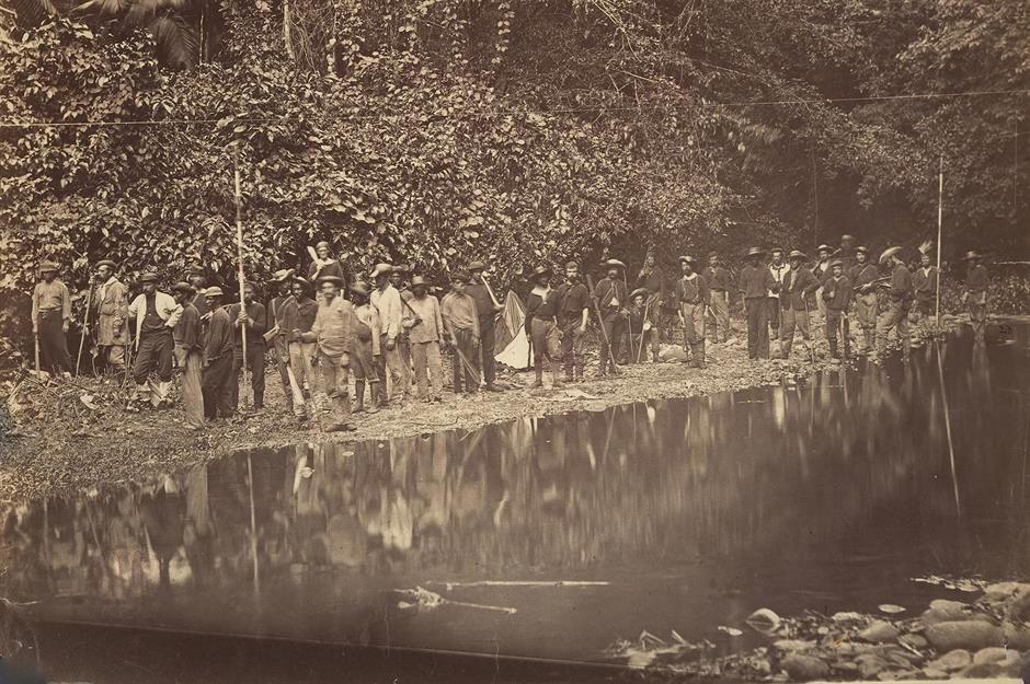
The Darien Gap is a sparsely inhabited, almost impenetrable isthmus in Panama that connects Central America to South America. Many have tried to tame it, and all have failed miserably. In 1698 banker William Paterson tried to colonise the area for Scotland – an endeavour that cost more than 2,000 lives and almost bankrupted the Scottish economy. In 1854 a US expedition battled starvation and insanity after getting lost in the jungle for 49 days. The 1870 expedition, pictured here, was better equipped, and boasted a telegraph cable connected to New York. Even so, its leader, Thomas Selfridge, later wrote that the trip had required "extraordinary persistence and willingness to endure hardships".
c.1873: Street scene, Cartagena, Colombia
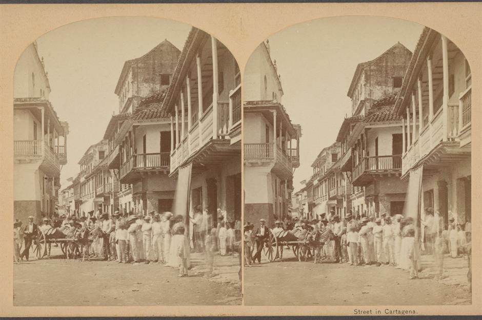
Founded by the Spanish in 1553, the northern Caribbean port of Cartagena was where Spanish ships loaded up the treasures they’d plundered from the New World to take back to Spain. By the 1840s the port had declined, but its proximity to the Darien Gap, meant that it continued to be an important jumping off point for expeditions to that untamed isthmus that separated Colombia from Panama. In fact, this photo was taken by the United States Darien Exploring Expedition when they passed through the port sometime in 1873.
1875: Coffee harvesting in Las Nubes, Guatemala
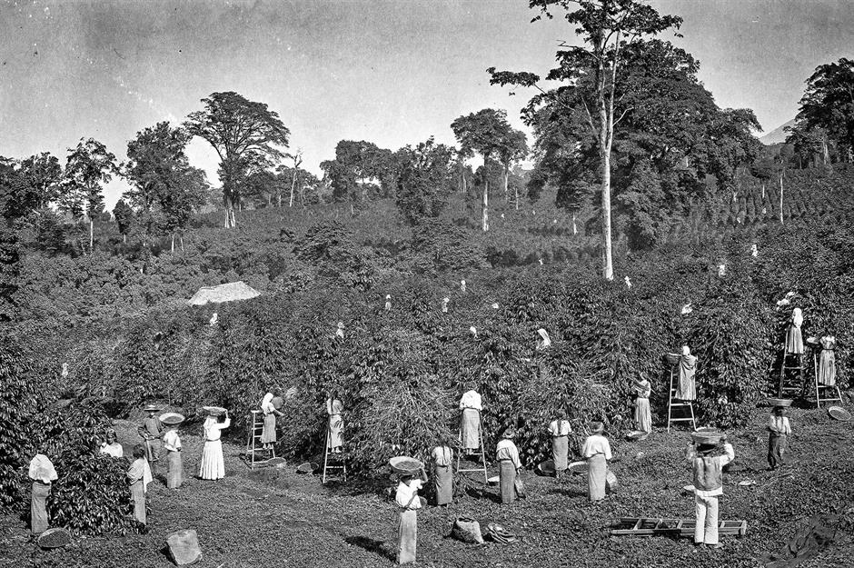
Coffee as an export crop came late to Guatemala, and by the time it did in the mid-19th century European tastes were demanding higher-quality beans. Harvesting such beans was a long and laborious process, and was resisted by the local Indigenous workforce. Shortly after this photo was taken, and a while after the Liberal Revolution of 1871, the coffee growers got their wish when the new president issued a decree reviving forced labour drafts – now called 'mandamientos' – which required Indigenous communities to work paid jobs on plantations whether they wanted to or not.
c.1880: Copacabana, Brazil
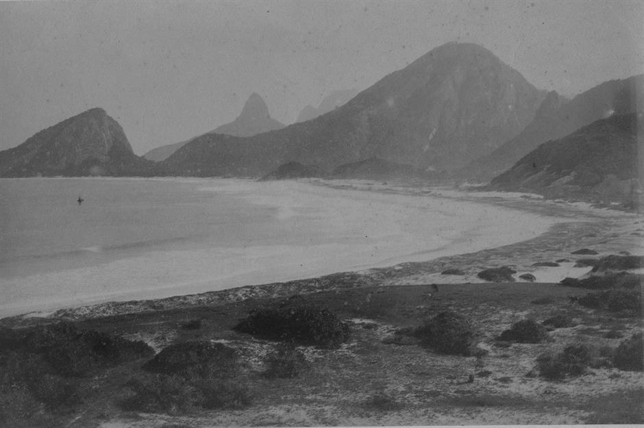
Occupying a narrow strip of land between the mountains and the sea, glorious Copacabana is arguably Rio de Janeiro’s most beautiful and most famous beach. Today the 2.5-mile-long (4km) sugar-white beach is backed by skyscraper hotels, apartments, nightclubs, restaurants, cafes and bars. But when this photo was taken nearly 150 years ago Copacabana was undeveloped and empty, save for the socozinhos (a species of heron) that gave the area its original Tupi name, Sacopenapa ('the way of the socos').
1882: Tikal ruins, Guatemala
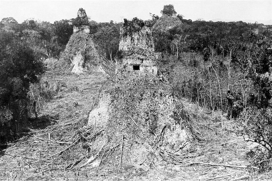
This extraordinary photo of the Maya ruins of Tikal in Guatemala was taken by Englishman Alfred Maudslay as he undertook the first real studies of the ancient city in the early 1880s. Tikal, or Yax Mutal to give it its Maya name, was the centre of a civilisation that had flourished for 1,400 years before collapsing during the 9th century. Maudslay spent much of his time clearing the vast swathes of forest that had engulfed the spectacular plazas and temples that sprawled across the enormous site.
c.1883: Market at Quetzaltenango, Guatemala
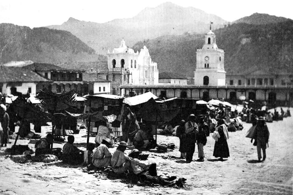
By the tail end of the 19th century, the mighty cathedrals and town squares built by the Spanish had become the centres of Latin American life, especially in mountain towns. Here we see a market in Quetzaltenango in Guatemala’s western highlands. In such towns people from surrounding villages would generally travel in once a week to worship and sell produce in the central square. Just a few years after this photo was taken, the Santa Maria volcano seen in the background erupted and nearly destroyed the town.
1884: Military parade in Valparaiso, Chile
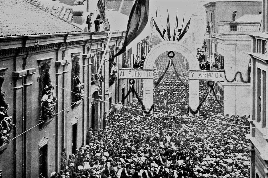
The War of the Pacific between 1879 and 1884 saw Chile battle Bolivia and Peru over disputed territory along South America's Pacific coast, including parts of the mineral-rich Atacama desert. The war ended with a Chilean victory, gaining the country a significant stretch of resource-rich land, and pushing Peru into a seven-month civil war. Here we see victorious Chilean troops parading through the streets of Valparaiso in 1884.
1884: Opening of Bogota’s tramway, Colombia
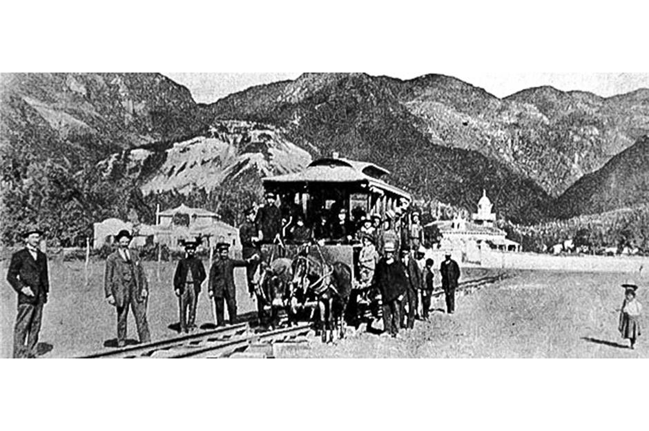
Perched high in rugged, barely accessible mountains, Bogota was not reached by railway until 1889. But that didn’t stop a group of wily US businessmen from building the city’s first tramway service a good five years earlier. The carriages were imported from Philadelphia and were pulled by mules along wooden tracks. The service ran from Plaza de Bolivar to Chapinero and cost five centavos to ride. Here we see the tramway being inaugurated on 24 December 1884.
c.1885: Sombrero sellers in San Marcos, Mexico
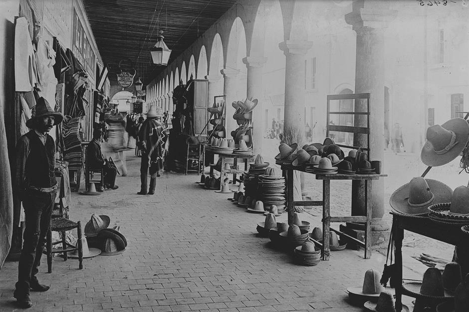
Sombreros as we would recognise them today first appeared in the 15th century and take their name from the Spanish word for shade, 'sombra'. Gentlemen typically wore sombreros made from felt, while the sombreros worn by peasants were made from straw. Here we see sombreros of all shapes and sizes – and social classes – for sale under a portico in the market of San Marcos in the Mexican state of Guerrero around 1885.
1885: The Great Plaza at Copan, Honduras
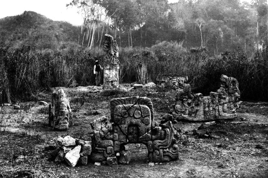
By 1885 Alfred Maudslay was conducting excavations at the Maya ruins of Copan in Honduras, and here we see him posing beside a stela in the Great Plaza. First discovered by Diego Garcia de Palacio in 1570, Copan is regarded as one of the most important sites of Maya civilisation and is famous for its Hieroglyphic Stairway, a beautiful staircase decorated with 1,260 intricate hieroglyphic symbols that may have formed part of the most accurate solar calendar ever produced by the Maya.
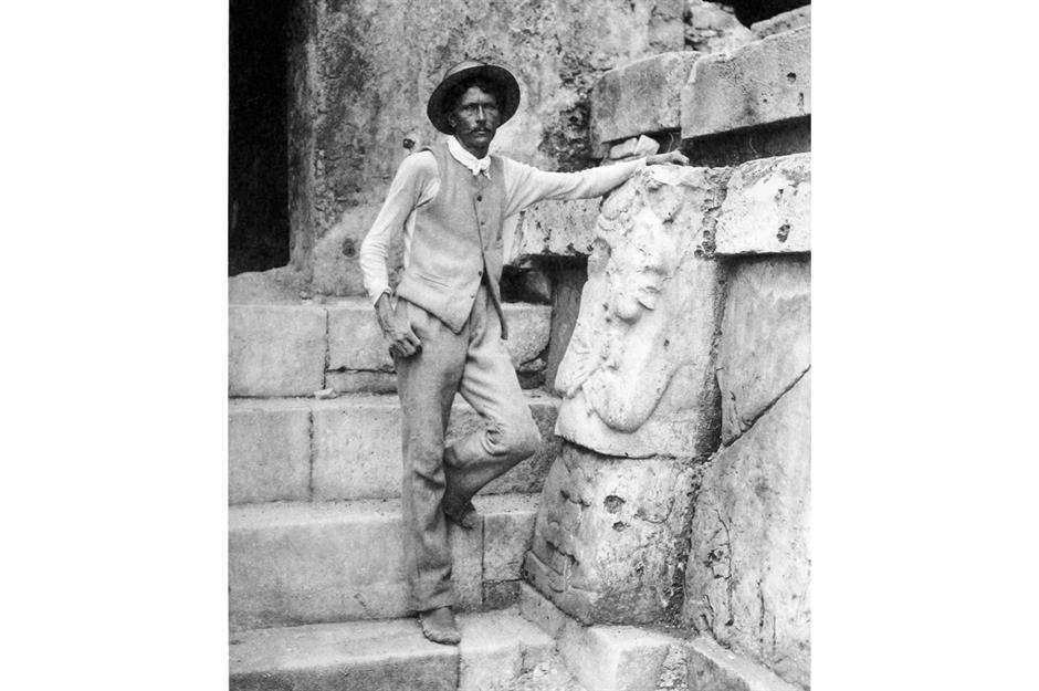
1885: Alfred Maudslay in Quirigua, Guatemala
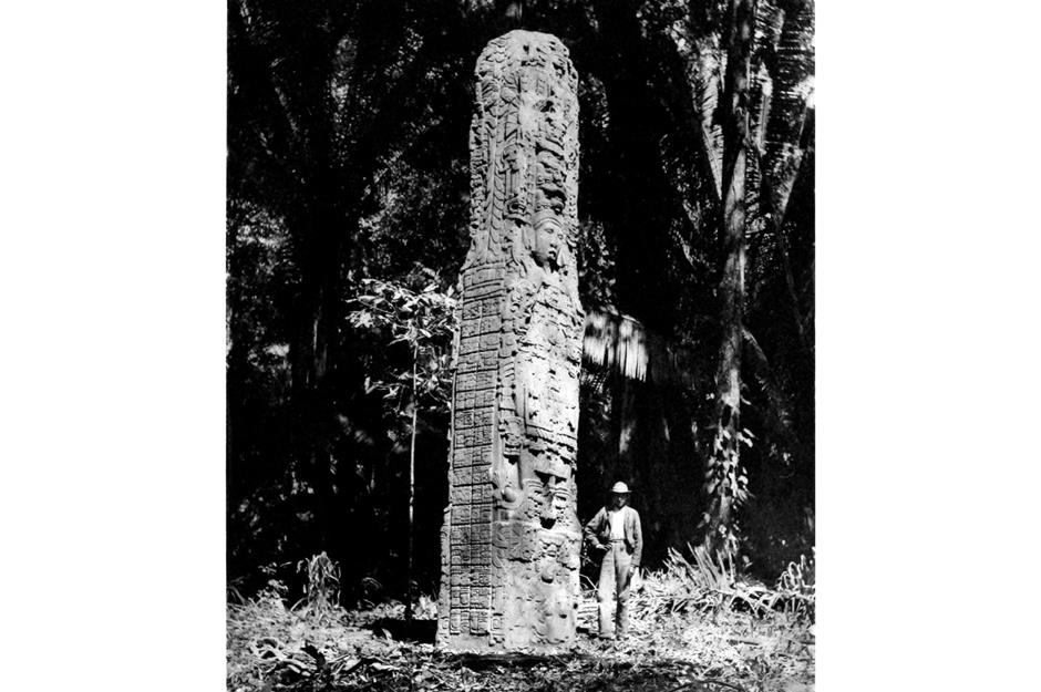
After Copan, Maudslay moved on to Quirigua in southeast Guatemala. Here he excavated the pyramids and plazas of the classic Maya city that flourished here in the 8th century AD, prospering as a trading centre for jade and obsidian. The site is famous for its intricately carved sandstone stelae. Here we see Maudslay posing beside one of the tallest Maya stelae ever found, a 24-foot-tall (7m) monster known simply as Stela F.
1888: Fuegian fishermen, Chile
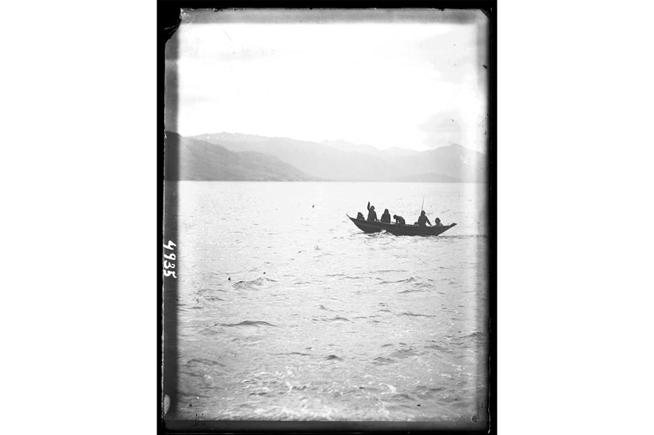
Tierra del Fuego sits at the very southern tip of South America, a wild, barren region where bitter winds sweep up from Antarctica across the untamed Southern Ocean. Imagine the surprise of the crew of the United States Fish Commission Steamer Albatross when they came upon these hardy Fuegian fishermen out in their canoe in the Straits of Magellan, just off Otter Bay, in 1888. Albatross was halfway through a circumnavigation of South America. The fishermen were out catching dinner.
1889: Alfred Maudslay in his room at Chichen Itza, Mexico
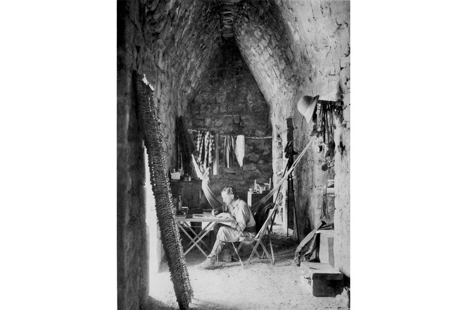
Maudslay's expedition to the Maya ruins of Chichen Itza in Mexico in the late 1880s was a pivotal moment for the ancient site. He equipped himself with advanced photographic equipment and surrounded himself with a team skilled in excavation and conservation. He carefully documented his discoveries, leaving an invaluable legacy for modern scholars. Here we see him in his 'office' in the southern chamber of Casa de Monjas at Chichen Itza, working on notes that would become part of his seminal publication, Biologia Centrali-Americana.
1889: La Iglesia at Chichen Itza, Mexico
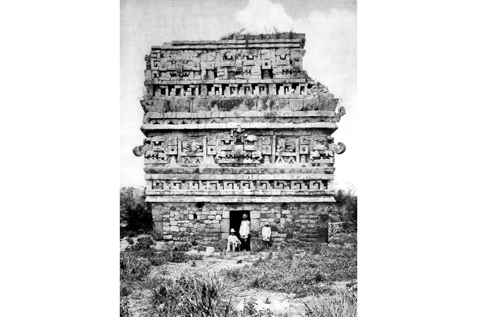
The findings of Maudslay’s numerous expeditions across Central America were collated into Biologia Centrali-Americana, also known as Contributions to the knowledge of the fauna and flora of Mexico and Central America. It was a stunningly detailed treatise, issued in 215 parts between 1879 and 1915, and featured photographs and illustrations by the skilled team that accompanied him on his journeys. This striking photo of La Iglesia at Chichen Itza was taken by one of his best photographers, HN Sweet.
c.1890: Brazil’s first tourist railway
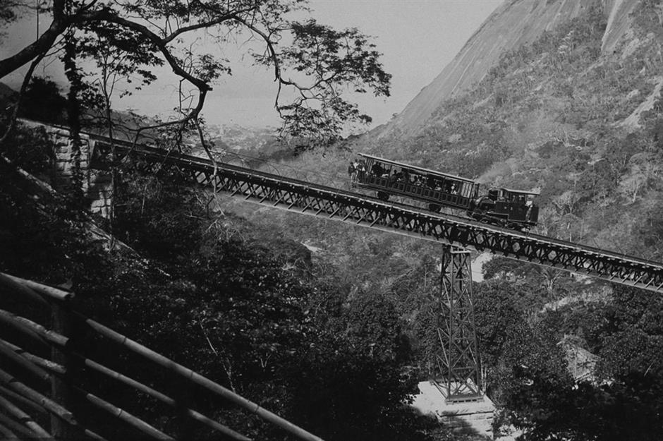
Corcovado is a 2,310-foot-high (704m) granite peak in Rio de Janeiro, famously topped by the world-renowned statue of Christ the Redeemer. Should you visit, you may very well catch the Corcovado Rack Railway, seen here just a few years after it opened, to the top. The railway was the brainchild of Brazilian engineer Pereira Passos who studied in France and based his design on the high-gradient railways of Switzerland. In 1910 it was electrified, becoming one of the first electric rail lines in Brazil.
c.1890: Porters in La Paz, Bolivia
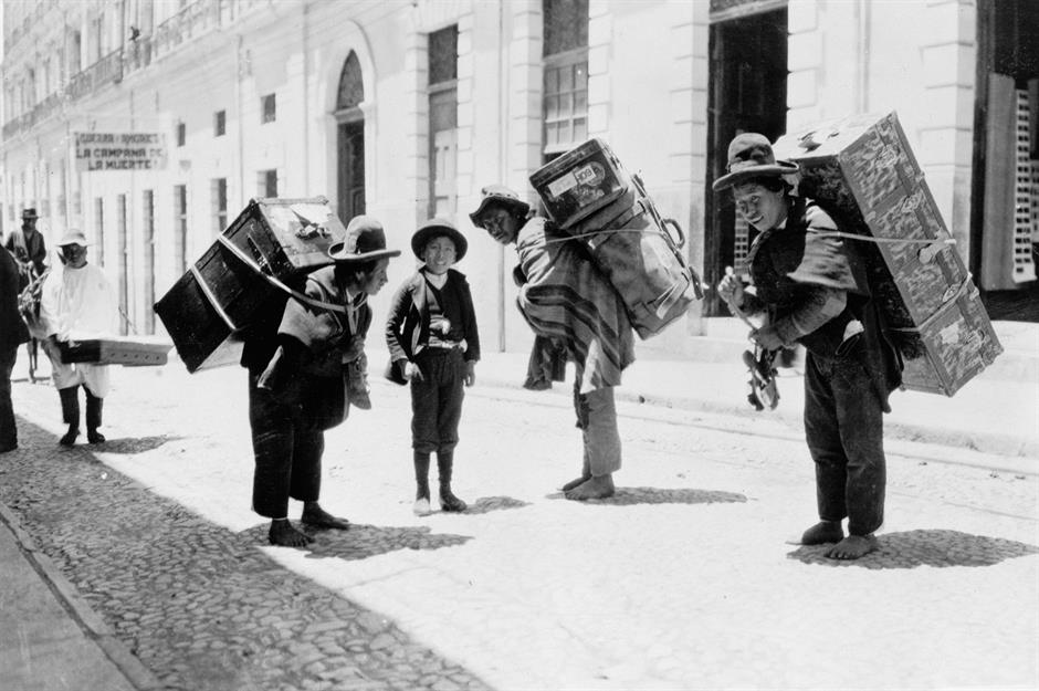
Here we see a group of Bolivian porters carrying trunks on their backs on the high-altitude streets of Bolivian capital city La Paz around 1890. The photo was taken by Frank George Carpenter, an American journalist, photographer and lecturer who achieved a level of fame in the early 20th century with a series of books called Carpenter's World Travels.
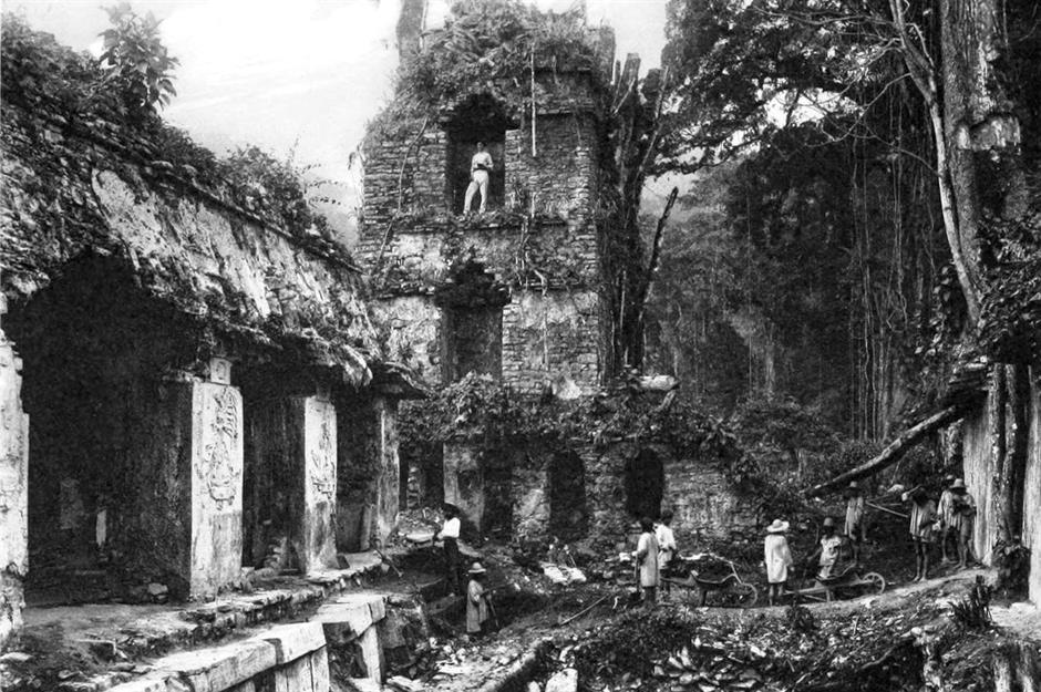
c.1891: Guide at Palenque ruins, Mexico
Here we see a photo of Gorgonio Lopez, taken by our good friend Alfred Maudslay at the magnificent Maya ruins of Palenque in Mexico. Lopez had been introduced to Maudslay by a fellow archaeologist and went on to be his guide on several other expeditions. It's probable that Maudslay had just made a 'squeeze' of the statue on the right – a process that involved laying a thin sheet of wet paper on its surface and pressing into the indentations with a brush to record their markings.
c.1891: Western Court and Tower at Palenque, Mexico
Maudslay used these 'squeezes' to create plaster casts of the monuments and their inscriptions. Here we see Maudslay in a tower at Palenque looking out across the western court, which was covered with intricate hieroglyphics. Maudslay made nearly 500 plaster casts all told, which he donated to London's South Kensington Museum (now the V&A) before they were transferred to the British Museum in the early 20th century. They remain an important record of the wonders he uncovered, many of which have eroded in the intervening century.
1895: Exploring the Santo Anastacio River, Brazil
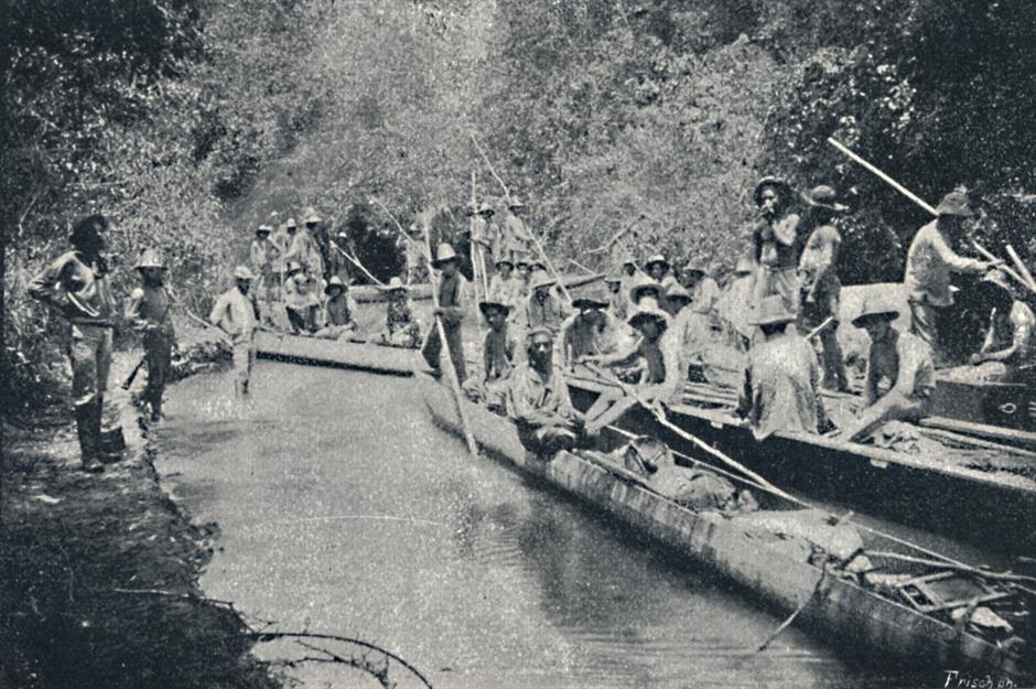
The first European to explore the Amazon River was a Spanish soldier called Francisco de Orellana. His 1541 journey saw his men battle tribes of female warriors (according to their accounts), whom he compared to the amazons of Greek mythology. Others followed, but to this day Amazonian explorers are loath to venture far beyond the river itself, for fear of being swallowed up by the wilderness and lost forever. Exploring other mighty rivers on the continent could be just as treacherous. Here we see an expedition on Brazil's Santo Anastacio River in 1895.
1896: French workers attempting to build the Panama Canal
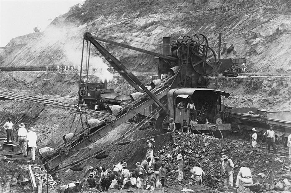
It was the Americans who completed the Panama Canal in 1914 to great fanfare, but it was the French who envisaged and began this monumental engineering project in 1881. French diplomat Ferdinand de Lesseps set up a company financed by small French investors to build the canal, and even engaged Gustave Eiffel, the man behind Paris’s famous tower, to build the locks. Here were see labourers working Gold Hill in 1896, three years before the whole project collapsed into a huge financial scandal that saw both de Lesseps and Eiffel appear in court.
1899: Araucanian woman weaving, Chile
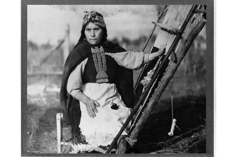
Despite the great advancements being made across the continent, life continued as it always had in many of its remote and Indigenous communities. Here we see a member of the Araucanian population who lived in the fertile valleys of south-central Chile. She is wearing silver jewellery and sitting in front of her loom – the Araucanians were known for weaving fine fabrics which they traded with the Inca to the north.
c.1900: Incan wall in Cusco, Peru
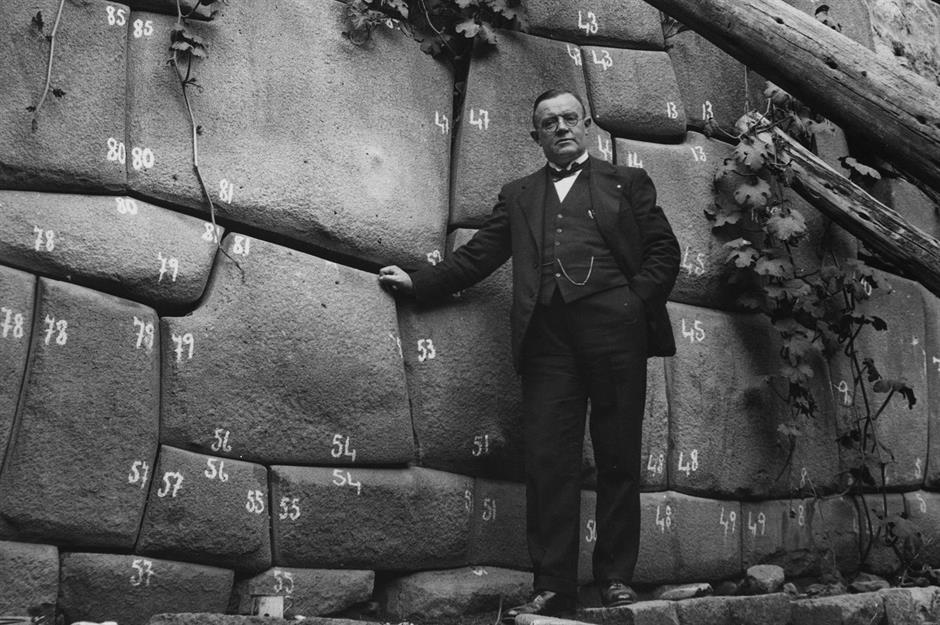
At the turn of the century Latin America continued to be a place where the ancient and modern worlds uneasily coexisted. Here we see a German scientist in Cusco applying typical precision to the task of moving an Inca wall – each stone is carefully numbered so that it could be reassembled accurately elsewhere. The Incas were sophisticated stonemasons who believed that rocks were living entities with inherent agency. Each stone in a wall was chosen and matched together with others through skill, patience and forced labour.
c.1900: Uruguayan Gauchos
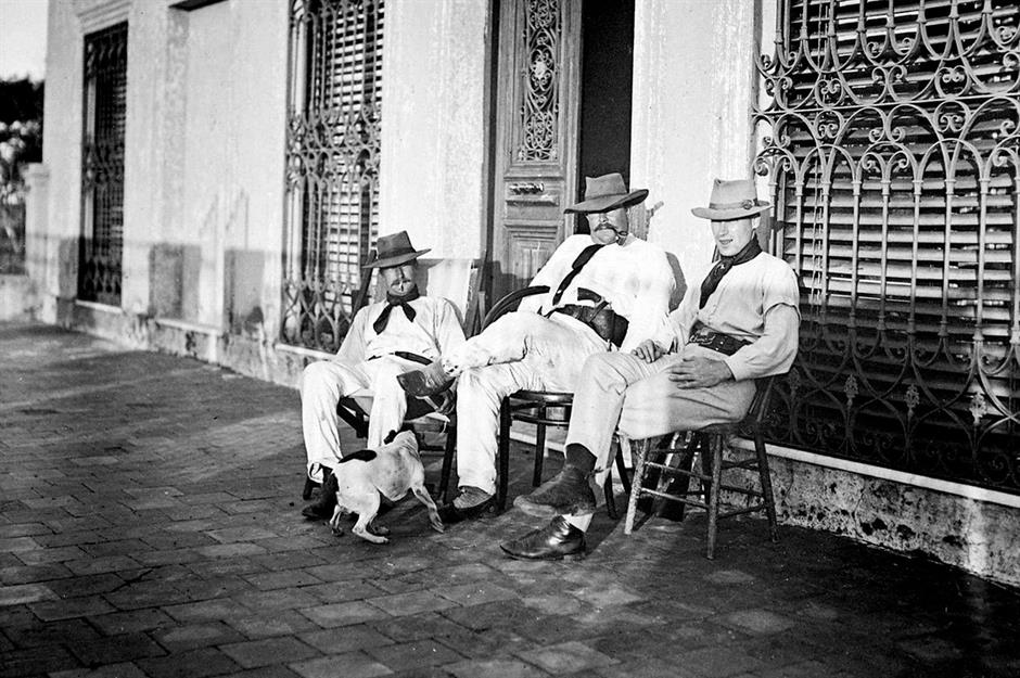
Uruguay is the second smallest country on the South American continent, but at the turn of the century it was one of the most prosperous. It's a land of gently rolling pampas, perfect for sheep and cattle farming, two industries that have brought the nation much wealth. As in neighbouring Argentina, there was a strong gaucho culture, as seen in the striking confidence of these three gauchos photographed around 1900. They played a vital role in the nation’s most profitable enterprise – and they knew it.
Read on for incredible then-and-now images of Latin America's most famous landmarks
Comments
Be the first to comment
Do you want to comment on this article? You need to be signed in for this feature