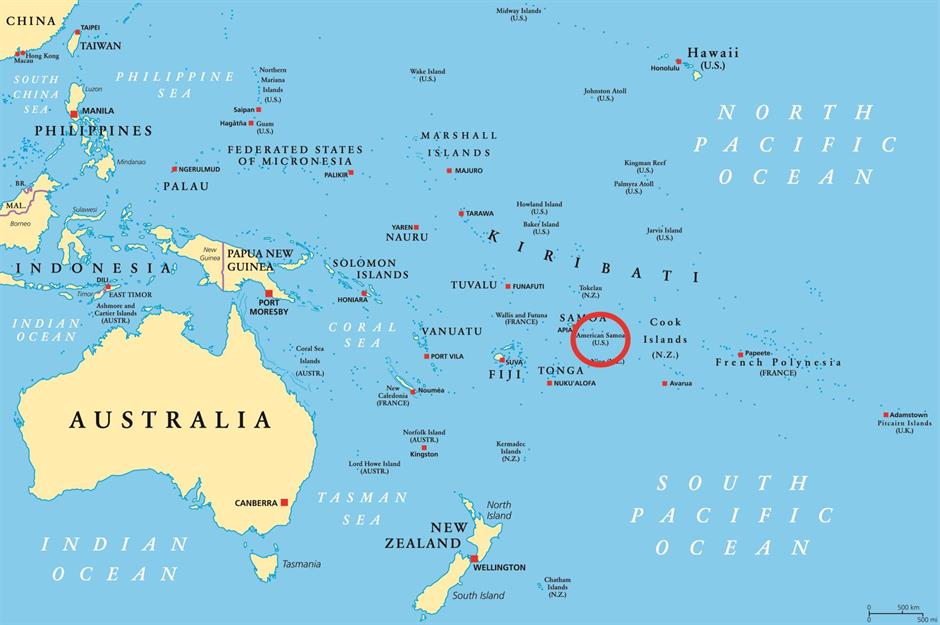
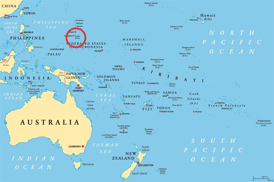
American islands that aren't in North America
The hidden map of America
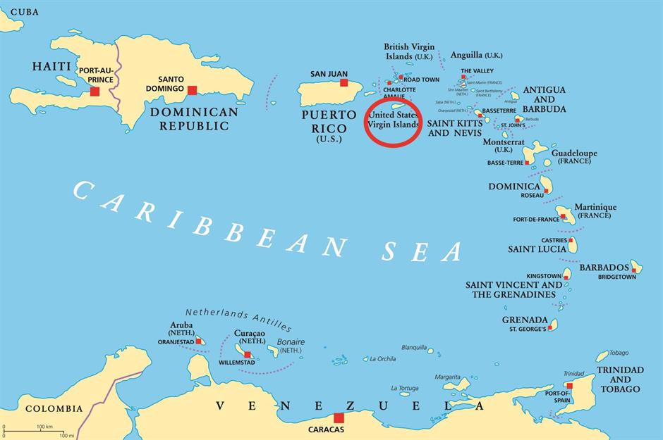
The map of the US we're all familiar with is actually inaccurate – at least in the sense that it leaves out territories and other islands recognised by the US Geological Survey. With tropical rainforests, volcanoes, white sandy beaches, technicolour coral reefs and some of the nation’s oldest fortifications, these fascinating isles are worth getting to know.
US Virgin Islands
US Virgin Islands
US Virgin Islands
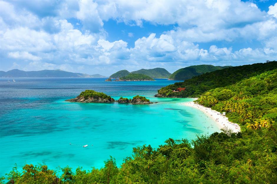
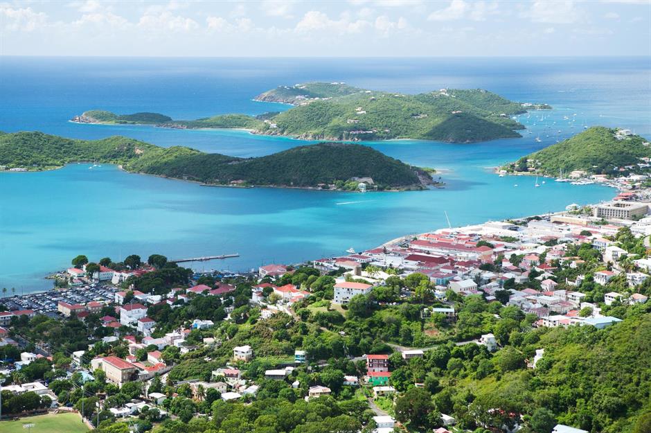
Unsurprisingly the islands are usually a popular cruise-ship stop with St Thomas, the most developed of the three, having two of the Caribbean’s busiest ports. It’s home to historic buildings including one of the oldest synagogues in the western hemisphere, St. Thomas, as well as the 17th-century Blackbeard’s Castle, which was used by the notorious pirate according to legend. Plus, there are plenty of pristine beaches, including Magens Bay and Trunk Bay (pictured).
US Virgin Islands
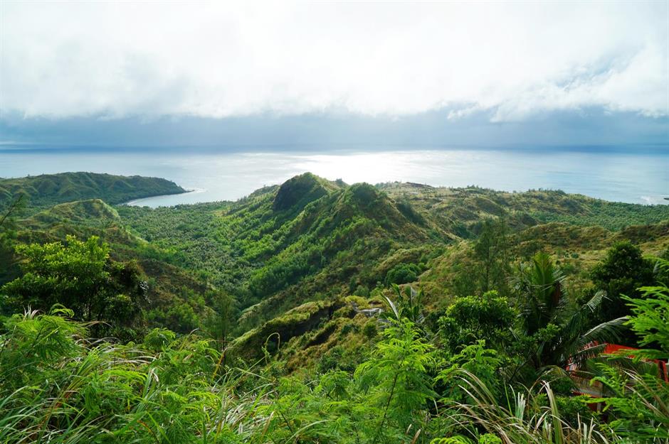
Northern Mariana Islands

Northern Mariana Islands
Northern Mariana Islands
Another member of the Northern Mariana Islands is the tiny, 12-mile long (19km), three-mile (5km) wide island of Tinian. While it might seem a million miles away from the US mainland, it has an intriguing connection to New York. During the Second World War, it was used as a US air base and its streets were named after those in Manhattan, including 42nd Street, Broadway and Lenox Avenue. Pictured is the idyllic Tachogna Beach.
Love this? Follow our Facebook page for more travel inspiration
American Samoa
American Samoa
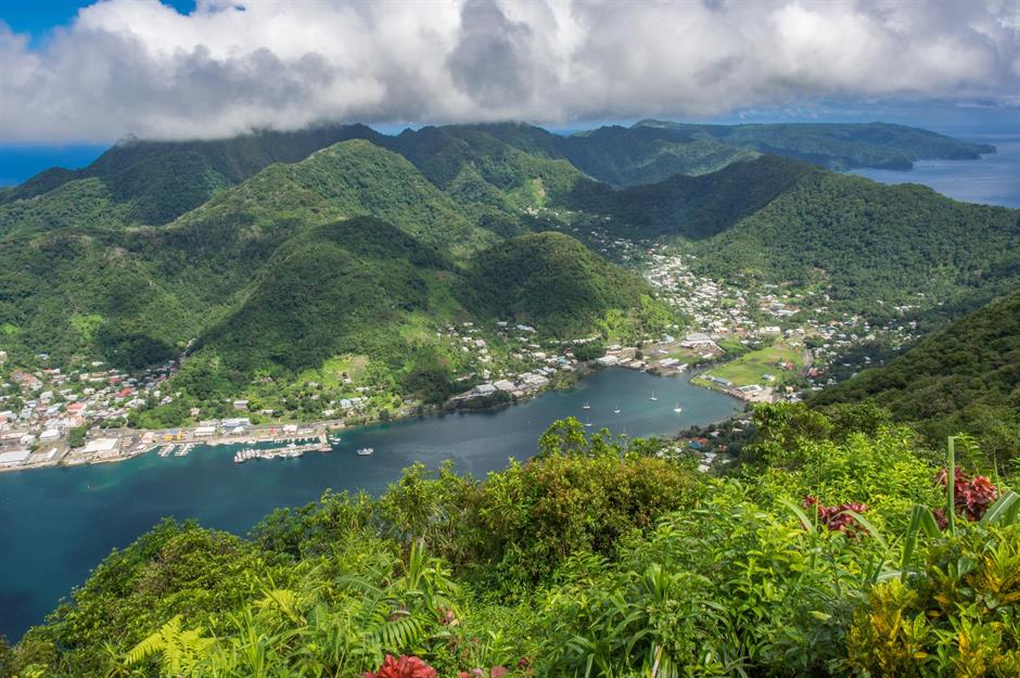
American Samoa
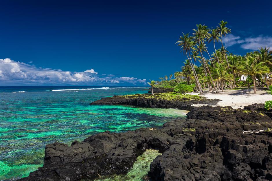
The territory includes five inhabited islands – Tutuila, Ta‘ū, Olosega, Ofu, Aunu'u and two coral atolls. The big draws for tourists in this Polynesian paradise are snorkelling above colourful coral reefs and whale watching. Parts of three islands are included in the National Park of American Samoa, which is also the only US National Park south of the equator.
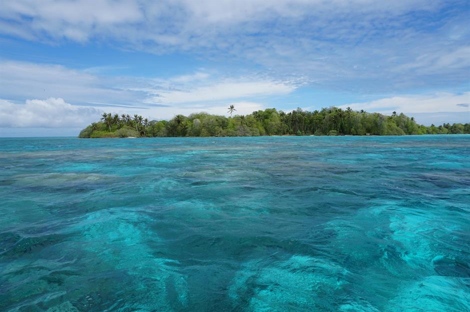
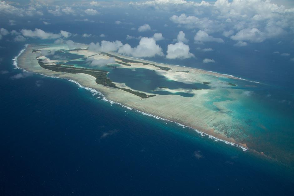
Palmyra Atoll and the Pacific Remote Islands Marine National Monument
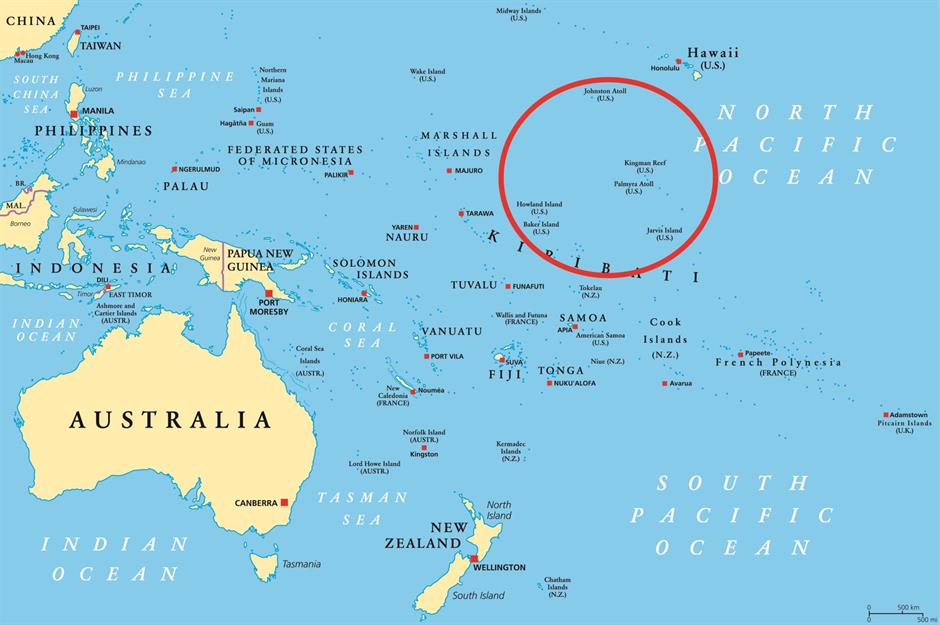
Palmyra Atoll is a ring-shaped constellation of roughly 50 uninhabited islets in the Pacific Ocean, whose combined size is just around four square miles (10sq km). The archipelago can only be visited with permission from the US Fish and Wildlife Service (USFWS). The neighbouring islands – Baker Island, Howland Island, Jarvis Island, Johnston Atoll, Midway Atoll, Wake Atoll and Kingman Reef – are part of the Pacific Remote Islands Marine National Monument, one of the largest marine conservation areas in the world.
Palmyra Atoll
A number of unusual occurrences have led some to believe that Palmyra Atoll is cursed. In the 1800s, several ships wrecked near its shores, one of which was the Angel in 1870. Although its crew were thought to have made it to shore, their murdered bodies were found on the island a few months later by a passing vessel. Even more terrifying is the tale of Malcolm and Eleanor Graham, an American couple who embarked on a global voyage with the intention of visiting Palmyra Atoll – yet didn’t make it out alive...
Palmyra Atoll
The couple set sail on their boat, Sea Wind, in 1974, yet a few months after leaving the US they were reported missing. Investigators who visited Palmyra Atoll found no trace of them or their possessions. Six years later, a couple visiting Palmyra Atoll discovered a metal container with a skull, several bones and a woman’s watch inside it. Inquiries found that they belonged to Eleanor Graham, who had been brutally murdered on the island. Duane Walker, who had previously been charged with stealing the Grahams' boat Sea Wind, was found guilty of the murder, while Malcolm's body was never found.
Baker Island
Howland Island
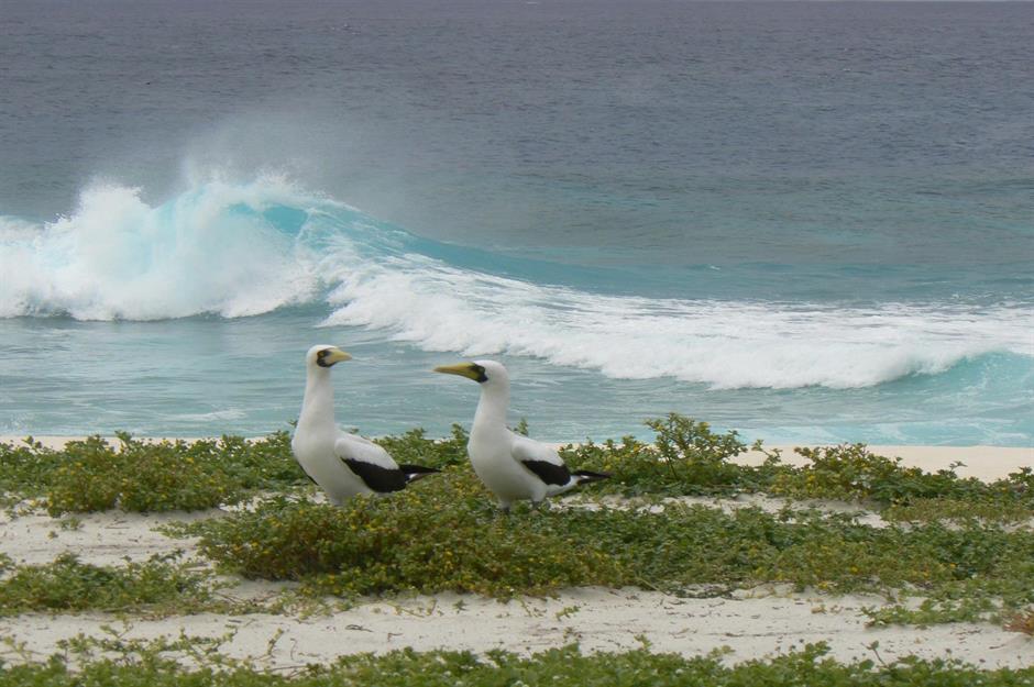
Very few people visit Baker and nearby Howland Island, but those who wish to need permission from the US Fish and Wildlife Service (USFWS). The reason behind America’s ownership of these two isles? Seabird droppings. Yes, you read that right. In the 1840s, American farmers discovered that guano, meaning seabird droppings, was a powerful fertiliser and so in 1857 the Guano Act was established. Still in place today, the law gives the US the right to claim and “mine” unclaimed islands for the stuff.
Jarvis Island
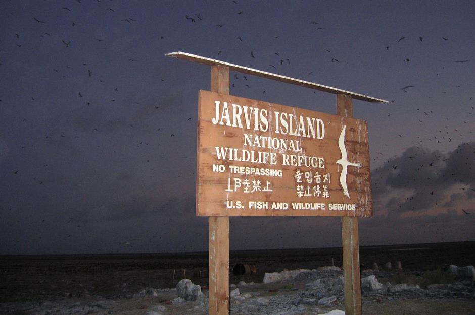
In 1856, Jarvis Island also came under US possession due to the Guano Act. Guano deposits were sourced here for the following two decades and it’s thought that a whopping 8,000 tonnes were collected, yet the mines were abandoned in 1878, along with the island itself. Today, the infrastructure of an abandoned town remains on Jarvis Island, serving as a haunting reminder of this forgotten period of history.
These American destinations feel like you're visiting another country
Kingman Reef
Navassa Island
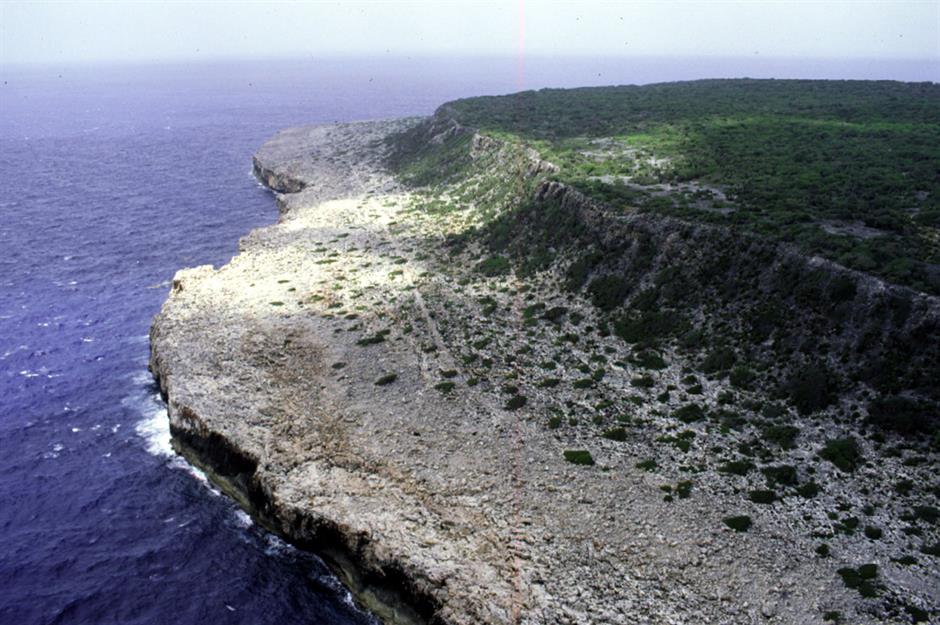
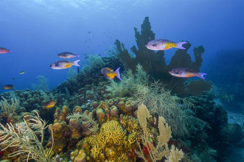
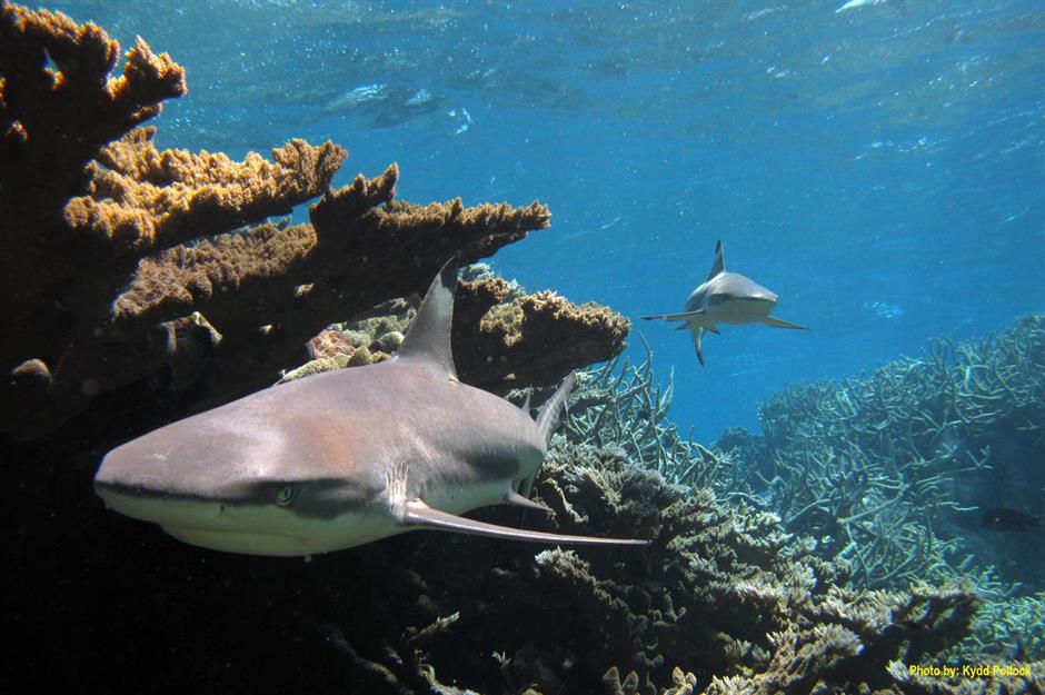
Navassa Island, located between Haiti and Jamaica, may only be a puny three square miles (7.8sqkm), yet it’s thought to be a haven for endangered coral. That’s according to scientists working on the Global Reef Expedition, who discovered that the surprisingly rich ecosystem had avoided the damage from overfishing, climate change and pollution that other coral reefs in the region had experienced. Navassa Island was claimed by the US in 1857 under the Guano Act.
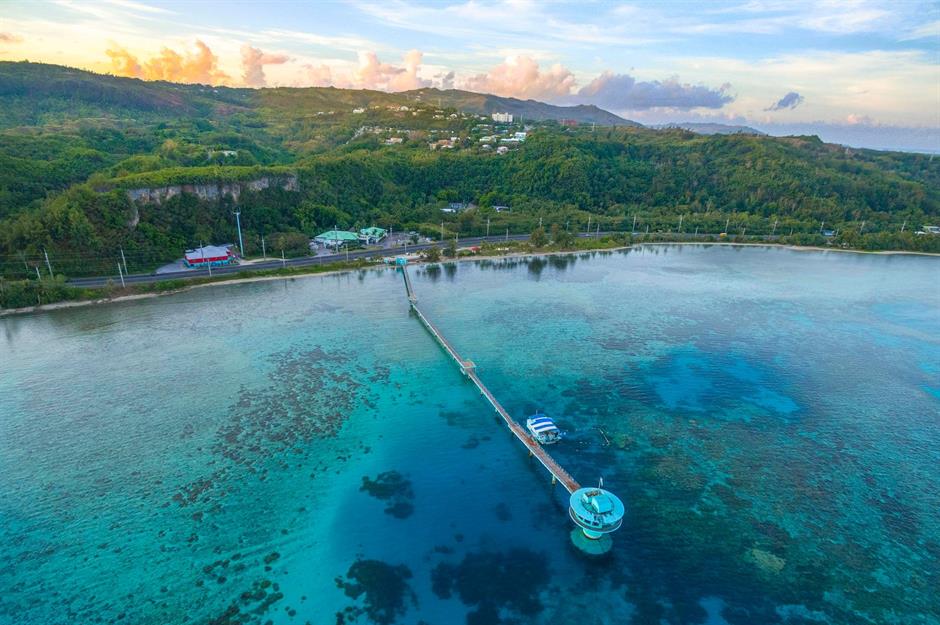
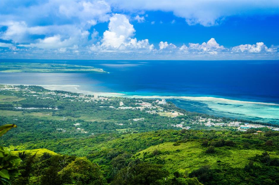
Guam
Guam may be remote, but it’s got all the ingredients for beach holiday bliss: it’s home to azure waters, unspoiled coral reefs and white sandy beaches. Located roughly 5,800 miles (9,300km) west of San Francisco in the North Pacific Ocean, it’s the largest island in Micronesia with a total area of 217 square miles (561sq km).
Guam

Guam
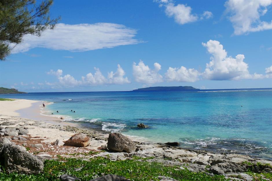
Away from developed Tumon Bay, where most of Guam’s big hotels are, there are deserted beaches, charming little villages, tumbling waterfalls and the mighty Mount Lamlam. The island’s highest peak at 1,332 feet (406m), Lamlam offers amazing views of the island and beyond.
Discover the world's landmarks that are under threat from climate change
Comments
Do you want to comment on this article? You need to be signed in for this feature