The real places that don't exist on the map
The world's most secretive spots

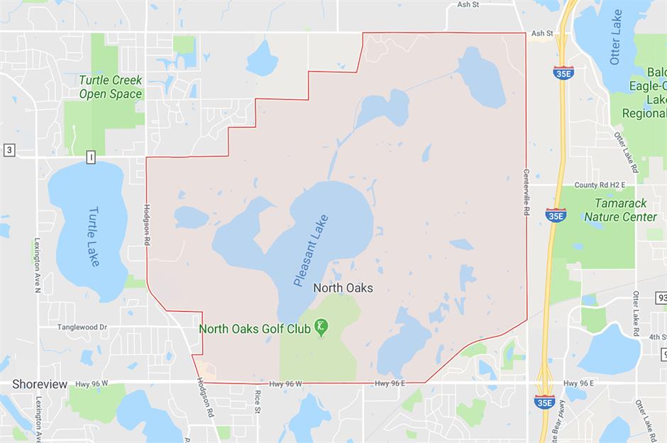
North Oaks, Minnesota
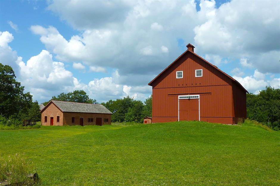
You'll find the little town of North Oaks in Minnesota pinned on Google Maps – but you can't snoop around the municipality on Street View. All Street View data was removed at the request of local residents, who begrudged images of their home town being available to strangers on the internet.
North Oaks, Minnesota
Parts of the Faroe Islands, Denmark
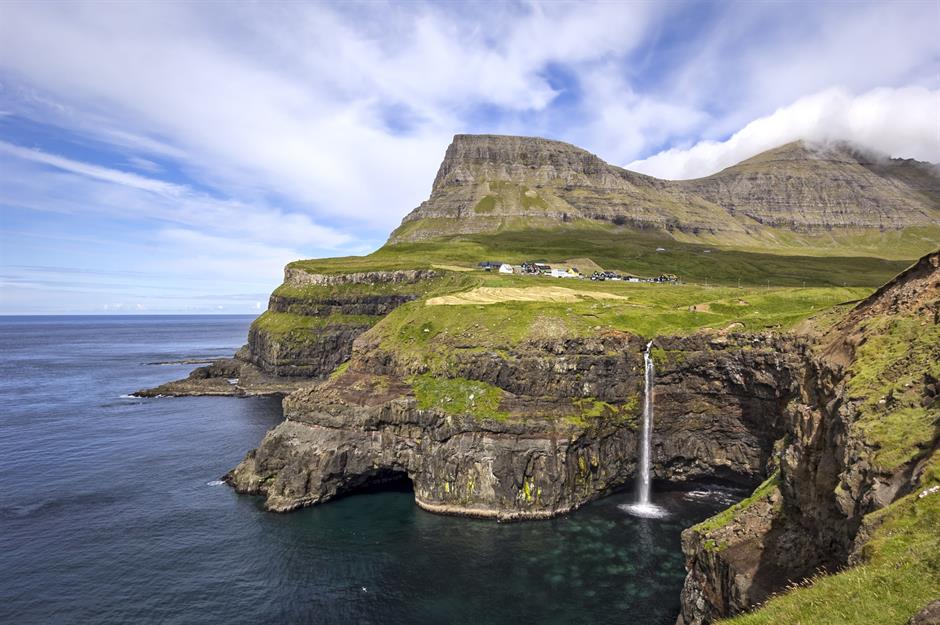
Until recently, the Faroe Islands weren't found on Google Street View at all, due to their sheer remoteness. But one woman's plan to strap cameras onto sheep living on the archipelago, in order to capture their surrounding landscapes, inspired the tech giant to take up the job themselves. Google proceeded to send camera equipment to locals, who helped collect the images needed. Now you can see highlights such as Mulafossur waterfall (pictured) through your computer screen.
Parts of the Faroe Islands, Denmark
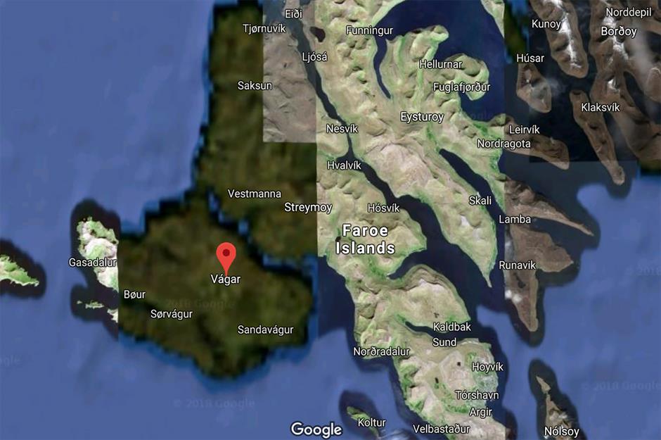
But despite this progress, there are still vast swathes of the rugged islands that lack Street View data and, when using Google Earth, parts remain blurred and pixellated. The affected area includes the westerly island of Vágar. Though it's likely due to teething problems and the islands' seclusion, others have conspired that it's down to fishing rights or the presence of an old WWII military base.
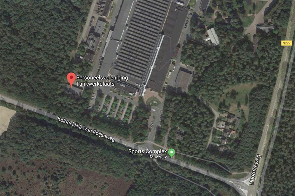
Personeelsvereniging Tankwerkplaats, the Netherlands
Penitentiary Baumettes, Marseille, France
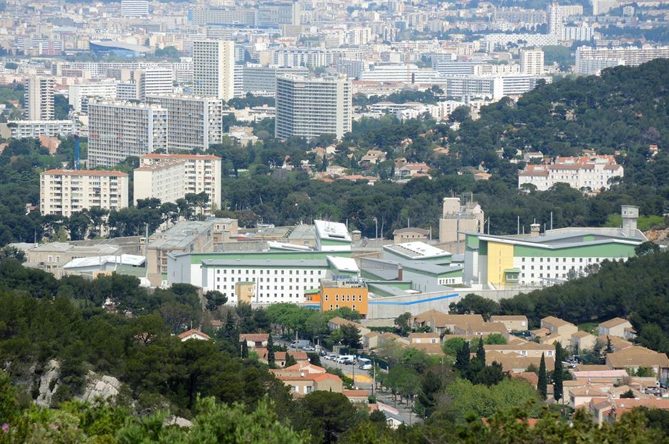
Penitentiary Baumettes, Marseille, France
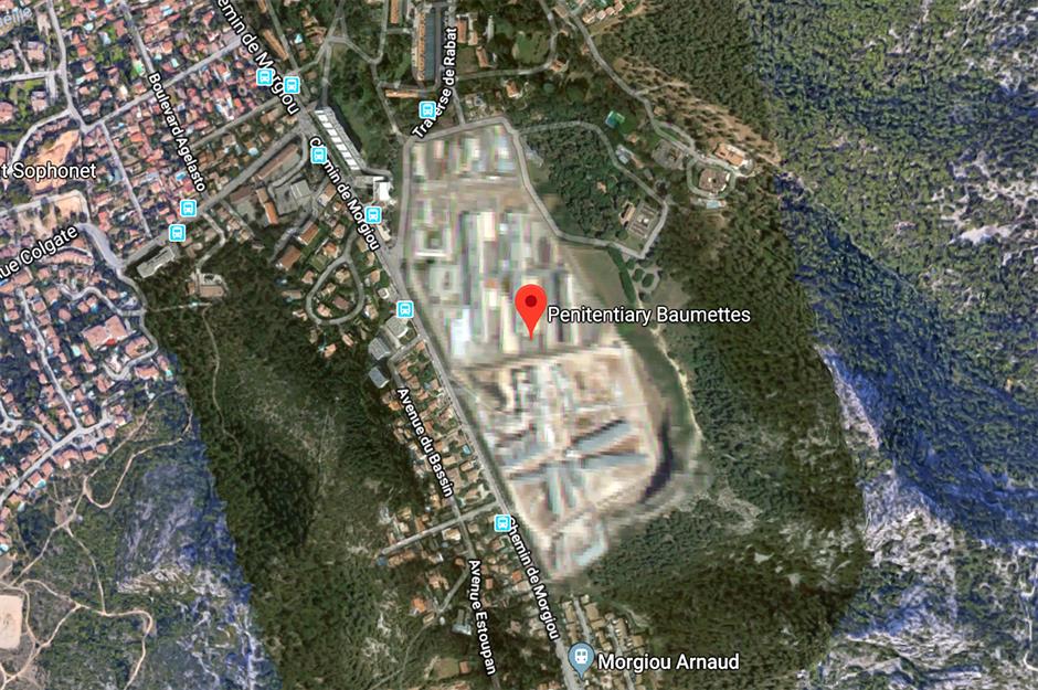
It's not uncommon for prisons to be obscured on the platform – most cite the privacy of those incarcerated and a need for confidentiality as reasons for it. But Baumettes also made the headlines when inmates posted hundreds of selfies on Facebook, some including drugs and other contraband, raising questions about the institution's security.
HAARP Research Facility, Alaska, USA
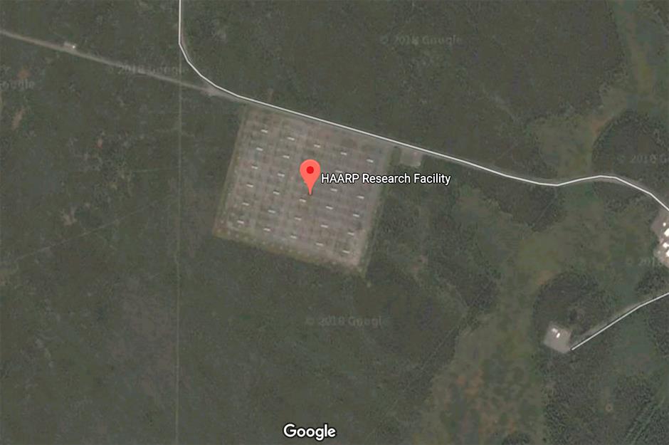
This research site in Alaska studies the ionosphere – a part of the Earth's upper atmosphere. When viewed on Google Earth, it appears blurred and darkened. Theories as to why the centre is concealed abound. Some are convinced it's a UFO testing site, while others believe the US government can control the weather from this base. The complex is joint funded by the University of Alaska, the Air Force and the Defense Advanced Research Projects Agency (DARPA).
Billingsgate Island, Massachussets, USA

Billingsgate was once a small but thriving fishing village with around 30 homes. But the island, and its important lighthouse, was battered by storms, the fiercest of which were in 1855 and 1882. Unable to live in such inhospitable conditions, and with their beloved lighthouse eroding and tattered, the last of the island's inhabitants left by 1912. Today, what's left of the island is revealed at low tide and you can take a boat out to visit it. It does not exist on Google Maps.
House on Princeport Road, Stockton-on-Tees, England
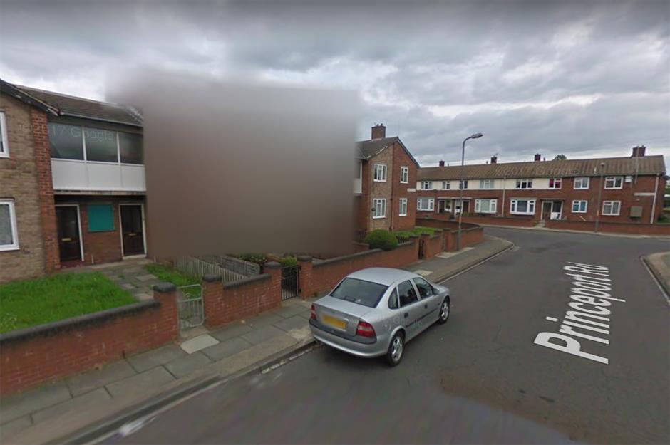
The owner of this unassuming house on Princeton Road in Stockton-on-Tees was bemused to find that her house was entirely obscured on Google's Street View. The occupier herself saw no reason that the property should be hidden and Google have made no comment. Some speculate that residents were simply too close to the window when Google's car came round to take photos, and the house needed to be obscured for privacy reasons. It remains a mystery.
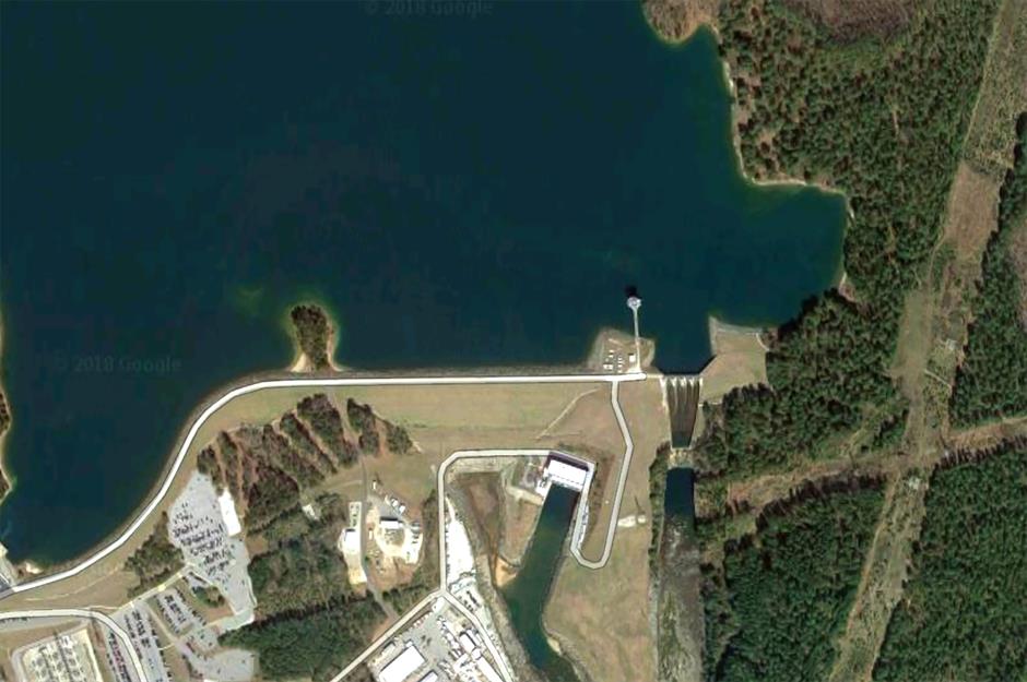
Keowee Dam, South Carolina, USA
Number One Observatory Circle, Washington DC, USA

Number One Observatory Circle, Washington DC, USA
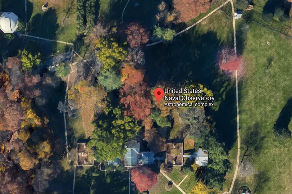
On Google Earth, the complex remains almost entirely obscured by trees and slightly pixellated. Theorists have mused that the haziness is to guard the Vice President's privacy, to protect confidential research carried out at the observatory, or because of an alleged secret bunker concealed below the property. Google have refuted this.
Super Brand Mall, Shanghai, China
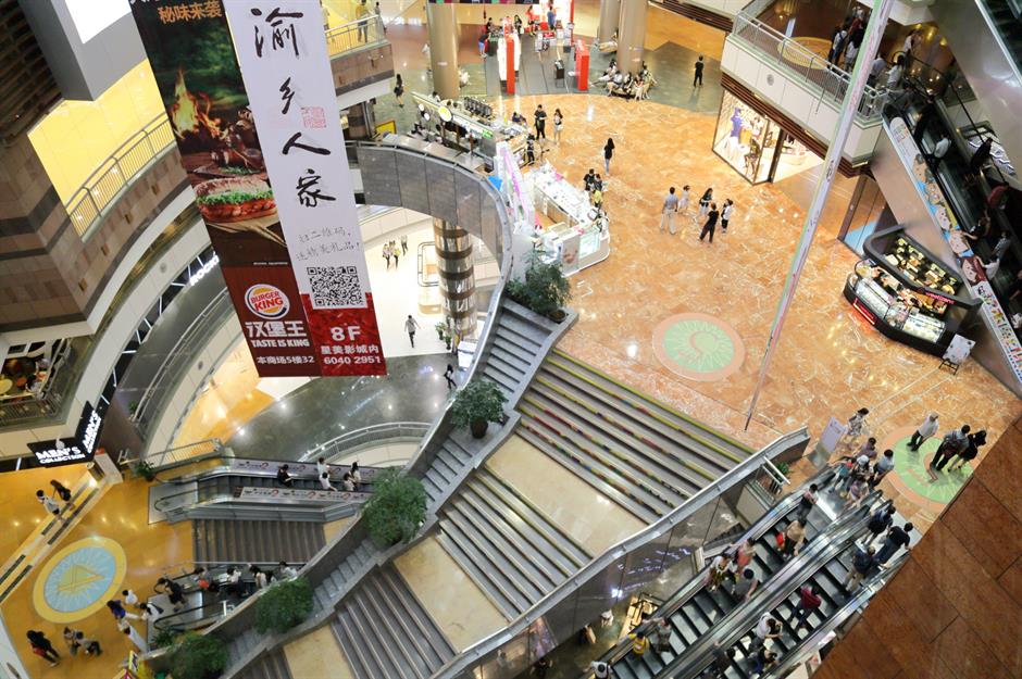
Super Brand Mall, Shanghai, China
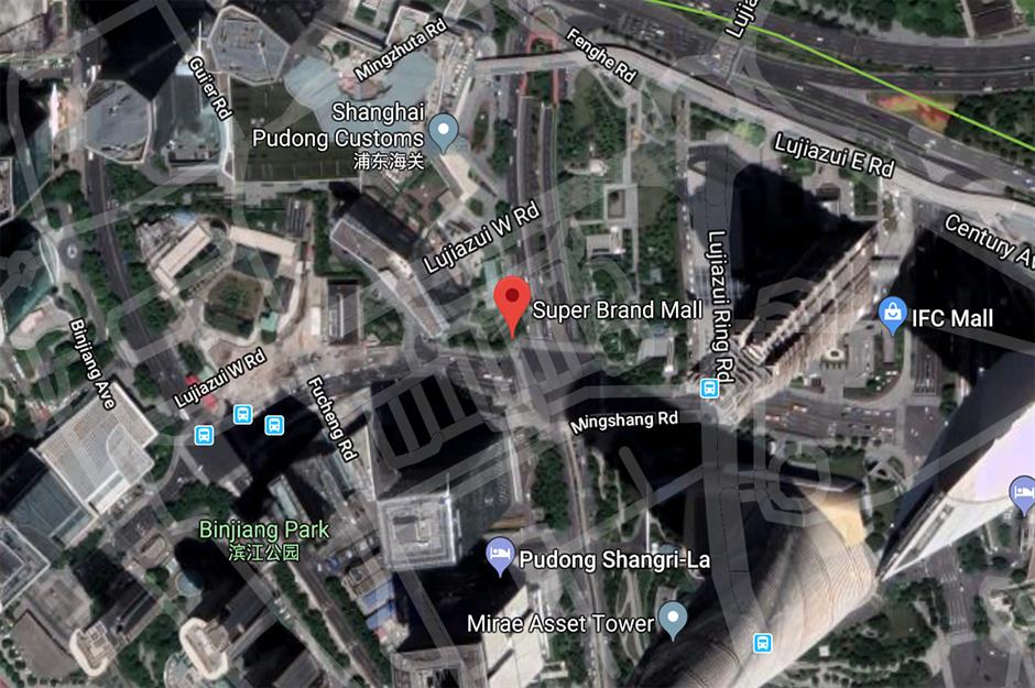
The issue is what's known as the China "GPS shift or offset problem". It's complicated, but it's essentially a clash between the coordinate system used in China and that employed by most other countries. Most digitised maps operate on the World Geodetic System 1984, while China uses a different one: GCJ-02 datum. It's this incongruity that causes the offset.
Valencia City, the Philippines
Valencia City, the Philippines
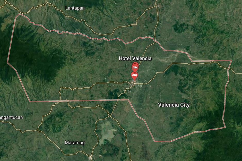
The reason for this is unknown but, of course, there's no shortage of conspiracy theories. While some put it down to technical issues or mere oversight, others insist the city is the headquarters of the government’s missile defence programme.
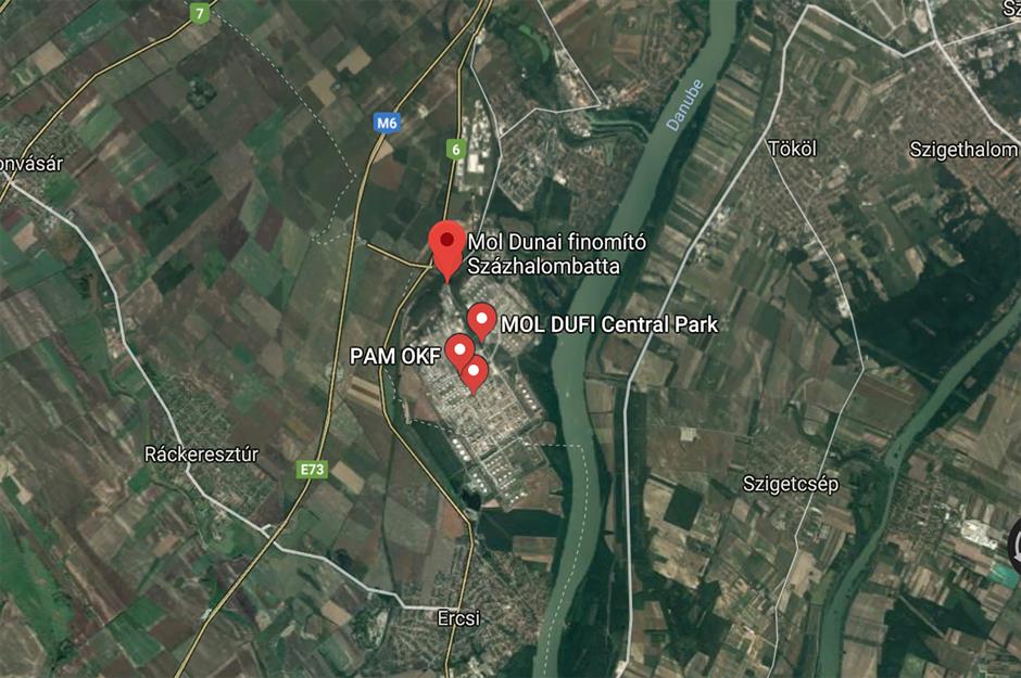
Oil refinery near Százhalombatta, Hungary
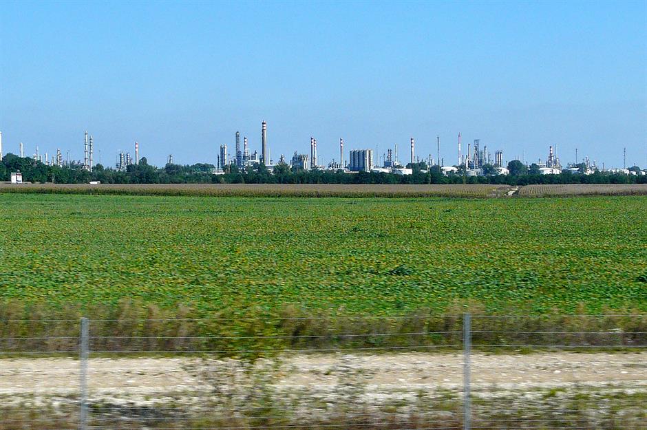
Oil refinery near Százhalombatta, Hungary
Moruroa, French Polynesia
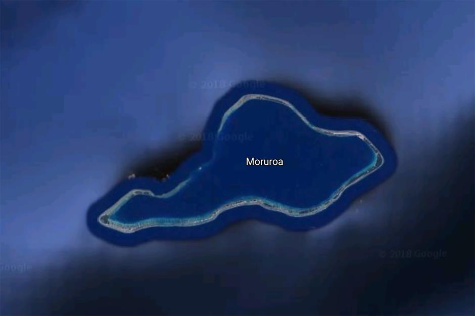
This remote South Pacific atoll remains blurred and pixellated on Google Earth. Some assume this is because Moruroa was the site of controversial nuclear tests by France until the 1990s. According to some reports, the Assembly of French Polynesia had been prepared to sue France to the tune of one billion dollars for reported damage caused by the tests.
Colonel Sanders' face, KFC outlets worldwide

Most of us are familiar with the beaming countenance of Colonel Sanders, the founder of chicken joint KFC. But if you stumble across the fast-food outlet in Google Street View, the face of the famous chicken connoisseur may well be obscured. This is due to Google's facial recognition technology, which pixellates human faces for privacy. The same applies to various adverts around the world.
Tantauco Park, Chiloé Island, Chile
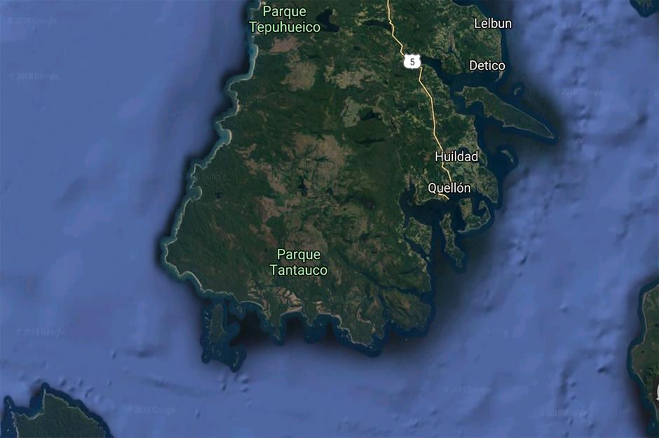
This park in the south of Chile's Chiloé Island was once completely excluded from Google Maps. Today it is marked by a pin, and you can take a look in Google Earth (though Street View remains unavailable). Some speculate that the park was concealed in order to protect its endangered species from poachers.
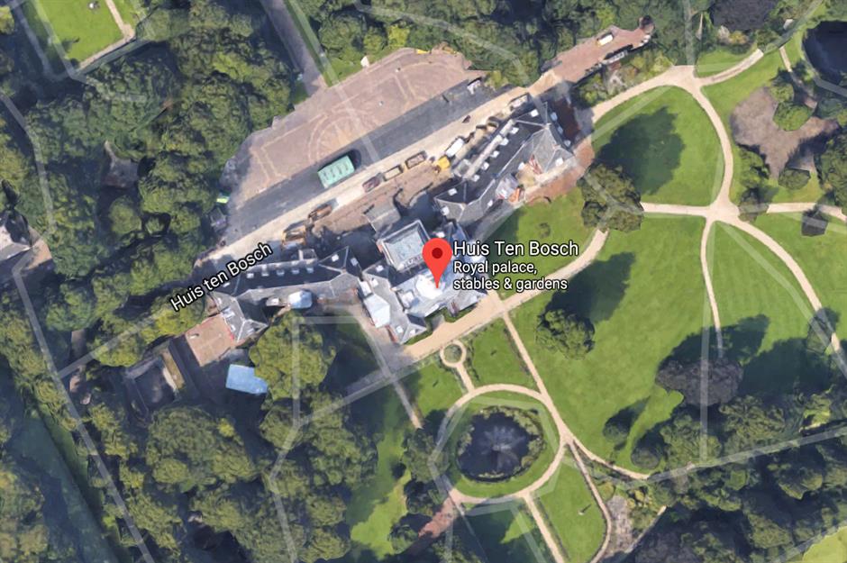
Dutch royal residences, the Netherlands
Area of Russian tundra, near Egvekinot
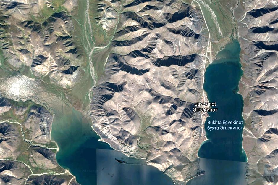
A seemingly random area of the Russian tundra, not far from the city of Egvekinot, was once blurred out in Google Earth with a hazy white blob. No such marking is visible here now, but speculations are still afloat. Some conspirators call the site a "secret city": a supposed nuclear research site. Others think it was a missile zone. No such speculations have been confirmed.
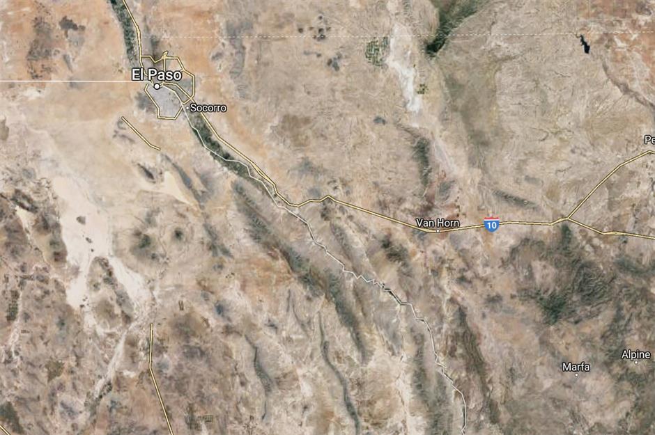
US/Mexico border at Hudspeth County, Texas
Minami Torishima Airport, Japan
Japan's Minami Torishima Airport was previously blurred in Google Earth, though it is now clearly visible. Since the airbase is operated by the country's Maritime Self-Defense Force, and was once a military airstrip, most believe the site was concealed for confidentiality.
Comments
Be the first to comment
Do you want to comment on this article? You need to be signed in for this feature